

Notes about using these tidal atlases, please read first.
Tidal atlases are A4 size booklets that display the rates of the tidal streams around our coasts in an easy to digest manner. Each consists of 13 or more diagrams showing the speed and directions of the tidal streams at any given hour, before or after high water at a standard (and specified) port. The mariner estimates where he will be at a certain time, and can consult the NP Tidal Atlas to see what effect the tidal streams will be having on his vessel at that time. Stream rates are given in knots (as opposed to MPH or M/sec) for Spring tides and Neap tides, some estimation is required for in between tides. The format and samples are below:
01,02 would mean 0.1 knts at neaps and 0.2 knts at springs
15,32 would mean 1.5 knts at neaps and 3.2 knts at springs
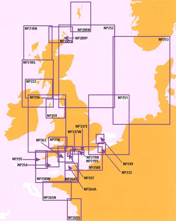
The key below shows the area coverage of the various atlases:
Most of these are on display within this "Tidal Stream" section. They are in Zoomify "Full Screen" viewers, and you can scroll through the hourly changes with ease. They may be useful for planning purposes.
We recommend that you purchase and keep on board your local NP Tidal Stream Atlas in hard copy. Around our coasts you'll be using it a lot !