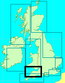
You are viewing the expanded version of this Harbour,
for faster browsing
use the regular version here


Bristol inc. River Avon and the Floating Harbour
Courtesy Flag
Flag, Red EnsignWaypoint
None GivenCharts
Admiralty, 1859, 1176, SC5608Rules & Regulations
Plenty..see text 9 Knts speed limit in R.AvonHazards
Approaches all dry, Much heavy shipping in approach, Fierce tides see textTidal Data Times & Range
HW Avonmouth = Dover-0415, HW Bristol 10 mins after Avonmouth. MHWS 13.2 MHWN 9.8 MLWN 3.8 MLWS 1.0 at Avonmouth (links)This site is designed for slower, roaming broadband connections, like you would get at sea, so it needs JavaScript enabled to expand the text.
General Description
Contacts (dial code 0117)
Bristol Harbour Office 903 1484
Cumberland Dockmaster (for the lock) 927 3633 VHF #14
Marina 921 3188
The historic city of Bristol lies 5 miles up the narrow and tricky River Avon. There is an enormous expanse of water held within the dockside area by various locks. The whole area is known as the Floating Harbour, and there's plenty of room for visitors.
It is hard to believe that unwieldy sailing ships could actually work their way up River Avon on the tide and get into the docks. A glance at the photo gallery will show you what a narrow, muddy passage this is. With all the twists and turns in the river, it's almost unbelievable that the docks were once packed out with tallships.
To support all this activity, all the usual dockside trades and businesses were represented from coopers (making wooden barrels), sail makers, ropemakers, chandlers, makers of ships biscuits, shipwrights...to hobblers. Hobblers were traditional rowing craft manned by up to 6 men... their purpose to help get the unwieldy sailing ships up the River Avon on the tide. They never actually towed the ships, more guided them gently while letting the tide and do work.
In all probability, bearing in mind the number of seamen knocking round the port at any given time, there were probably numerous taverns, boarding houses and bawdy houses !
Absolutely fascinating and well worth the effort to visit... even now.
From the point of view of the small craft Mariner in the new millennium, the passage up the River Avon to Bristol Floating Harbour is not too difficult providing home work has been done, tides studied, and various regulations and requirements complied with.
There is a untold berthing space within the Floating Harbour, most of which is run directly by Bristol Council, and an additional Marina completes the picture. Prices for visiting yachts are low (when compared to prices in other Bristol Channel Harbours), and the huge advantage is you are right in the city with all its facilities and attractions.
Throughout these notes links are given to specific pages in the Bristol Docks web site - this is because it is vast website and it can take some time to find the info you are looking for; we have taken the time for you!
Approach
Any kind of approach to Bristol needs good timing and planning.
The tides in the Severn Estuary are fierce with ranges of up to 13 m odd... these will have to be negotiated before you get anywhere near the River Avon. Streams can reach up to 5 knts at springs and 3 Knts at neaps.
The lock in to the Floating Harbour only opens from a couple of hours before HW to about 15 minutes before HW. The visiting yachtsman or motorboater therefore needs to arrive at the lock entrance within this window of time. If you miss the lock in by arriving too late you will have no alternative other than to exit the River Avon completely, as there is nowhere to stop safely while awaiting the next tide (With perhaps one exception covered later). In view of revised radio proceedures (see below) you should call the Bristol Dockmaster on 0117 927 3633 to tell him you are coming and which lock-in you hope to make. See full pilotage details:
If approaching from the West the small craft Mariner needs to be acutely aware of shipping approaching Avonmouth, Royal Portbury Docks or heading for The Avon (or vice versa). It is mandatory to keep listening watch on VHF channel 12 for Bristol VTS. Inward bound commercial vessels report when passing the English and Welsh Grounds fairway buoy (EW Grounds on the larger chart), and the Welsh Hook Buoy. Outward Bound ships report when leaving Avonmouth or Portbury docks, when passing Shirehampton (vessels leaving the River Avon), and when passing Lower Shoots Beacon (vessels leaving Sharpness).
Perhaps the ideal timing would be to be positioned somewhat south of the English and Welsh red-and-white fairway buoy around three hours before HW Avonmouth. This is shown on our approach chart as EW Grounds.
This will give you a bit more than an hour to reach Avonmouth, which lies 11 miles away. You will have a powerful tide underneath you at this time, so the distance shouldn't be a problem. You will then have plenty of time to move the 5 odd miles up the River Avon itself to reach the lock entrance. You will also have plenty of deep water in the river and a rising tide under you.
Small craft intending to go to Bristol are obliged to use the inshore route as shown on the plan (not the chart), and commercial vessels often pass within 200 m of Portishead Point. Small craft rounding Portishead Point therefore need to keep well inshore to avoid nerve wracking incidents. The tidal stream close in (where you are likely to be ) off Portishead Point turns West going 2 hours before high water, so it may be wise to plan to be here before then.
The Port Authority Chart for small craft can be seen in our navigation images or for more clarity downloaded at
The inshore route involves keeping outside of the shipping channel as defined by the buoyage, and closer to the shore. The plan shows the likely routes taken by heavy shipping. Be careful when departing Bristol; by the time you get down to the "North Elbow" the tide will have been runiing for the best part of three hours and you need to stay fairly close to the main channel to avoid the sandbank known as the English Grounds (that's from experience!)
The rules on contacting Bristol VTS have changed since I last sailed up there a few years ago and they have decided that they really don't want to talk to yachties (channel 12 is very busy when tugs are operating). You should listen out on channel 12 so that you know what's going on and only call them at Nelson Point when outbound from Bristol. I am told that it is now not even mandatory to call them before leaving Portishead Marina, unless you are in a flotilla, when the lead boat should call. This means that Bristol Docks get no notice of your intentions from the Bristol VTS and therefore you should call them on the phone in advance to advise of your intended arrival (see above)
The Portishead Cruising Club produces a very useful guide available here, you will have to locate the pilotage guide from the menu at the top:
http://www.portisheadcruisingclub.org.uk/Frame.htm
We will assume the small craft Mariner has done his sums and arrived in the region of The Royal Portbury Docks around two hours before local high water either by emerging from Portishead Marina or by coming up the Severn Estuary. We will also assume that the skipper has (if necessary) been in contact with Bristol VTS and has been given advice about shipping movements from the two busy commercial docks at the entrance to the River Avon. For those without VHF, you can phone the VTS on 0117 980 2638.
Ships using these docks are large and deep drafted, thus they are extremely restricted in their manoeuvring ability (especially considering the fast tides), and all small craft must keep keep clear of them.
The actual passage up the River Avon is commenced between the Royal Portbury Docks to the South and the Avonmouth docks to the North. There looks to be quite an expanse of water, but in fact, most of this is a huge mudbank with the entrance channel laying very close to the entrance to the Avonmouth Docks.
When making your entrance to the Avon be very aware of the cross tide which will be trying to sweep you up the Severn. If you get swept past you may have a struggle getting back. You need to turn across the stream and head directly towards the mud when about halfway between Portishead Dock wall and Avonmouth South pierhead, much, much earlier than you would like to. Remember that, by the time you get here there will have been about 8 meters rise so much of the "greenstuff" on the chart has plenty of water over it. To judge it watch the aspect of the Avonmouth Dock entrance; it needs to stay the same - if it starts to open clap on some speed and if it starts to close ease your helm a little to port
Keep close (the length of a long boat hook) to the South pier of Avonmouth docks as you enter the River (ie to the Northern side of the River entrance), and you'll soon be out of the cross tidal stream. Follow the lead in marks on 127° T until St George's leading marks come into view on the South bank of the river, they consist two white columns that line up or 173° T. Swing across the river towards these, keeping them in line and look out for a green conical buoy. This needs to be left well on your starboard side by changing course to centralise yourself in the River.
This can all be seen clearly on the inset to the Bristol approach chart provided.
Caution: Although the Port lays down speed limits in the River (Draft under 2m 9knots and over 2m 6knots) you should reduce speed (and thus your wash) when passing the creeks and pils where there are moored boats. There have been sinkings in recent years by inconsiderate skippers.
From here on the deepwater runs fairly centrally in the River, but favours the outsides of the bends, with the character of the River changing as you pass under the M5 Avonmouth Bridge. Nothing to do with navigation but do have one of your crew ready with a camera for this stretch. You will pass a spot marked on the chart as "Powder House"; in the days of sailing First Raters etc they all had to stop here and discharge all explosives before going on to the docks; and you will pass under the Clifton Suspension Bridge, a must for a photograph!
Once past Black Rock, in the approaches to the suspension bridge you can call the dock master directly on VHF channel 14 callsign "City Docks Radio" (0117 927 3633) with your radio switched to LOW POWER.
The normal lock operating times are 2 hours 35 minutes, 1 hour 25 minutes and 15 minutes before HW, and sometimes the lock remains open awaiting an inbound craft for up to half an hour. If you need to wait for a lock in you can tie up to the Hotwell pontoon which is on your port side about 200 m before the lock entrance, having passed under the Clifton Suspension Bridge.
Once through the lock, past the first swing Bridge, and into Cumberland Basin you will have to wait for the second swing bridge between the Basin and the Floating Harbour. This is nothing to do with the tide, they have to close the road to let you into the Basin and traffic is diverted over the Junction Lock bridge; it then has to be re-diverted back to normal and the Junction Lock bridge closed to let you through. it's quite an operation. When departing be aware that, at spring tides, the level in the river is above that in the docks and they put a stop gate on the Junction Lock an hour or so before the top of the tide and in order to catch the last lock-out you need to be there much earlier than you would expect (some times the evening before if departing before rush hour) - and when locking in on springs you will probably find that you motor straight into the entrance lock, wait for the Cumberland bridge to swing and motor into the Basin and then have to wait for an hour or so before they drop the stop gate. This is because there is no facility to lock down into the docks proper.
Much more useful information will be found on the Bristol harbour website, including full details about bridge openings and mooring opportunities. Check the links below:
https://www.bristol.gov.uk/streets-travel/arrival-to-and-departure-from-bristol-harbour
Berthing, Mooring & Anchoring
Within the River Avon the only real berthing option
........is at Crockerne Pill (covered shortly). If locking into the Floating Harbour, visitors have a choice of Bristol Marina, or the Harbour Authority alongside moorings. These are now dealt with including prices:
One option available to craft that can happily take the ground is to make advance arrangements with the Portishead Cruising Club who have their premises and moorings in Crockerne Pill, which is on the South side of the River Avon about half a mile past the M5 Road Bridge.
Small boats can enter this Creek about one a half hours either side of high water and obtain a sheltered and safe drying berth. It is best to make prior arrangements to obtain local knowledge, and the link to the club's website has already been provided above.
Assuming you are locking in to the Floating Harbour at Bristol, you will have a couple of choices for mooring up. It's worth being aware that dredgers operate within this harbour displaying the standard signals. Do not pass on the side of a dredger on which there is displayed two black balls or two red lights in a vertical line. Vessels should pass on the side of two green lights or two diamonds in a vertical line.
BD6438 Harbourmap 2015 (bristol.gov.uk)
Bristol Marina is on your starboard side about half a mile within the Floating Harbour. They offer berths when available together with a whole range of facilities covered shortly. A link to their website is provided below:
http://www.bristolmarina.co.uk/Pages/set.htm
The price here works at £2.75 per metre per day which includes navigation licence, electricity and VAT. The "Navigation Licence" includes passage through the Cumberland Basin lock.
You need to book ahead with them but they tell us that they do keep spare berths for visitors so it is worth a go. The slight disadvantage is that you are a fair way down the docks from the City; there is a bus but that only runs until 19:53 in the evening and there is also the regular water taxi which will drop you off right in the centre of Bristol.
Many other berths are provided in the Floating Harbour, and are best seen by reference to the chart provided on their website.
BD6438 Harbourmap 2015 (bristol.gov.uk)
These are all under the control of Bristol Harbour Authority, and a link has already been provided above. That link is run by the Council but links to everything you need including a downloadable map of the moorings and facilities
Their charges (2022) work out £2.20 per metre per day, reducing very nicely on a sliding scale for those who stay longer (24hrs, 48hrs, 7 days and 15 days). The two week licence will cost £15.70 per metre. That charge covers everything including passage through the entrance locks (which involves diverting the traffic, swinging the huge Cumberland bridge etc) - it really is an astounding deal.Overall there is plenty of room within the Floating Harbour but, if offered a choice, we would recommend you opt for the pontoons outside the Arnolfini Art gallery/restaurant. That's right up beside the Prince street Bridge on the eastern end of the plan but very busy ashore at the weekends
The berths in the Harbour Inlet are possibly quieter, being away from the madding crowd of the city centre, but they are restricted to yachts of 1.5 metres or less draft. There is a regular water taxi running up and down the docks from the SS Great Britain to "Neppies Steps" at the end of St Augustines reach in the centre of town. During the city rush hour this taxi runs as far as Templemeads Railway Station.
Initially the Council pontoons up by the Arnolfini look cheapest but you have to add in the cost of shore power, (included in the marina which also has free showers and toilet facilities) - and then add in the transport. cost to and from the Marina and the various deals available from both the Marina and the City for a week's stay etc. When you compare these prices with somewhere like Portishead Marina (£3.25 upwards) Bristol Docks is a no brainer.
Facilities
The Marina offers all the usual services for boats up to 20 m, with water and electricity on the pontoons, toilets showers and launderette ashore. Telephone connections are provided on the pontoons too.
Security is handled by CCTV and car parking is provided for berth holders.
Boats of up to 50 tons can be lifted with shoreside storage and full boatyard facilities including independent specialists. Bottled gas and Marine diesel are obtainable and there is a Force Four chandlers and a sailmaker on site.
The Marina however is not massive, and it would be worth arranging your berth here in advance to avoid disappointment.
Other berths around the Floating Harbour run by the harbour authority for short stays have varying facilities, but it shouldn't be too difficult to get water or arrange electricity.The electric hook up is charged by cards available from the HO and other outlets around the harbour) The authority also operate sewage pump out points and even have a mobile team that will come pump your boat where it lies.
For diesel you will have to go to the Marina
There are showers at the Harbour office in the Underfall Yard and also at the east end of the harbour near the pub called the Mud Dock (you can get an access key from the HM. It's worth knowing that Youth Hostel (beside the Arnolfini pontoons) will also let you have a shower there.
For the boat there are plenty of repair facilities in the area, together with Chandlers etc... check the directory.
Other facilities nearby include everything you would expect for a decent sized city. Transport connections via rail and road are excellent, coach services too.
Provisioning is simple enough as you are right in the middle of things, and absolutely all the usual High Street names will be found, together with banks and cashpoints. If you are looking for the larger supermarkets you will find that they are a good bus ride away as all those in the centre are of the "Express" or "Metro" with a limited range of choices.
All in all you may find you wish to linger here for a while.
History
Bristol Harbour is the harbour in the city of Bristol, England. The harbour covers an area of 70 acres (28.3 ha). It has existed since the 13th century but was developed into its current form in the early 19th century by installing lock gates on a tidal stretch of the River Avon in the centre of the city and providing a tidal by-pass for the river. It is called a floating harbour as the water level remains constant and it is not affected by the state of the tide on the river.
Netham Lock in east Bristol is the upstream limit of the harbour. Beyond the lock is a junction: on one arm the navigable River Avon continues upstream to Bath, and on the other arm is the tidal River Avon. The first 1 mile (1.6 km) of the floating harbour, downstream from Netham Lock, is an artificial channel known as the feeder canal, while the tidal River Avon follows its original route. Between Bristol Temple Meads railway station and Hotwells, the harbour and the River Avon run parallel at a distance of no more than 0.65 miles (1.0 km) apart. At Bristol Temple Meads railway station, the floating harbour occupies the original bed of the River Avon and meanders through Bristol city centre, Canon's Marsh and Hotwells. To the south, the tidal River Avon flows through an artificial channel known as the "New Cut". This separation of the floating harbour and the tidal River Avon reduces currents and silting in the harbour and prevents flooding. At Hotwells, the floating harbour rejoins the tidal River Avon via a series of locks and flows into the Avon Gorge.
Bristol Harbour was the original Port of Bristol, but as ships and their cargo have increased in size, it has now largely been replaced by docks at Avonmouth and Portbury. These are located 3 miles (5 km) downstream at the mouth of the River Avon.
The harbour is now a tourist attraction with museums, galleries, exhibitions, bars and nightclubs. Former workshops and warehouses have now largely been converted or replaced by cultural venues, such as the Arnolfini art gallery, Watershed media and arts centre, Bristol Industrial Museum (now closed, to be replaced by a new "Museum of Bristol" in 2011) and the At-Bristol science exhibition centre, as well as a number of fashionable apartment buildings. Museum boats are permanently berthed in the harbour. These include Isambard Kingdom Brunel's SS Great Britain, which was the first iron-hulled and propeller driven ocean liner and a replica of the Matthew in which John Cabot sailed to North America in 1497. The historic vessels of the Industrial Museum, which include the steam tug Mayflower, firefloat Pyronaut and motor tug John King, are periodically operated.
The Bristol Ferry Boat operates at the harbour, serving landing stages close to most of the harbour-side attractions and also providing a commuter service to and from the city centre and Bristol Temple Meads railway station. Two other independent ferry companies, Boatsatbristol.com and Number Seven Boat Trips, offer similar services. The Bristol Packet boats offer regular harbour tours with commentaries and also river cruises up the River Avon to Conham, Hanham and Bath and downstream to Avonmouth. In late July each year, the Bristol Harbour Festival is held, resulting in an influx of boats, including tall ships, Royal Navy vessels and lifeboats.
History of Bristol docks
Bristol grew up on the banks of the Rivers Avon and Frome. Since the 13th century, the rivers have been modified for use as docks including the diversion of the River Frome into an artificial deep channel known as Saint Augustine's Reach, which flowed into the River Avon. Saint Augustine's Reach became the heart of Bristol's docks with its quays and wharfs. The River Avon within the gorge, and the River Severn into which it flows, has tides which fluctuate about 30 feet (9 m) between high and low water. This means that the river is easily navigable at high-tide but reduced to a muddy channel at low tide in which ships would often run aground. Many ships were deliberately stranded in the harbour for unloading, giving rise to the phrase "shipshape and Bristol fashion" to describe boats capable of taking the strain of repeatedly being stranded.
As early as 1420, vessels from Bristol were regularly travelling to Iceland and it is speculated that sailors from Bristol had made landfall in the Americas before Christopher Columbus or John Cabot. After Cabot arrived in Bristol, he proposed a scheme to the king, Henry VII, in which he proposed to reach Asia by sailing west across the north Atlantic. He estimated that this would be shorter and quicker than Columbus' southerly route. The merchants of Bristol, operating under the name of the Society of Merchant Venturers, agreed to support his scheme. They had sponsored probes into the north Atlantic from the early 1480s, looking for possible trading opportunities. In 1552 Edward VI granted a Royal Charter to the Merchant Venturers to manage the port.
By 1670, the city had 6,000 tons of shipping, of which half was used for importing tobacco. By the late 17th century and early 18th century, this shipping was also playing a significant role in the slave trade.
Construction of the floating harbour
In the 18th century, the docks in Liverpool grew larger and so increased competition with Bristol for the tobacco trade. Coastal trade was also important, with the area called "Welsh Back" concentrating on trows with cargoes from the Slate industry in Wales, stone, timber and coal. The limitations of Bristol's docks were causing problems to business, so in 1802 William Jessop proposed installing a dam and lock at Hotwells to create the harbour. The £530,000 scheme was approved by Parliament, and construction began in May 1804. The scheme included the construction of the Cumberland Basin, a large wide stretch of the harbour in Hotwells where the Quay walls and bollards have listed building status.
The tidal new cut was constructed from Netham to Hotwells, with another dam installed at this end of the harbour. The Feeder Canal between Temple Meads and Netham provided a link to the tidal river so that boats could continue upstream to Bath. However, the new scheme required a way to equalise the levels inside and outside the Dock for the passage of vessels to and from the Avon, and bridges to cross the water. Jessop built Cumberland Basin with two entrance locks from the tidal Avon, of width 45 ft (13.7 m) and 35 ft (10.7 m), and a 45 feet (13.7 m) wide junction lock between the Basin and what became known as the Floating Harbour. This arrangement provided flexibility of operation with the Basin being used as a lock when there were large numbers of arrivals and sailings. The harbour was officially opened on 1 May 1809.
SS Great Britain.
Patterson's yard within the harbour was used for the construction of many ships notably Brunel's SS Great Western in 1838 and the SS Great Britain in 1843. They were some of the largest ships to have been built at the time, and ironically hastened the decline of the city docks by proving the feasibility of large ships. The SS Great Britain was to be towed away from her builders, to have her 1,000 hp engines and interior fitted out on the River Thames, but her 48 ft (14.6 m) beam was too big to pass through the lock. Thus the SS Great Britain was moored in the Floating Harbour until December 1844, before proceeding into Cumberland Basin after coping stones and lock gate platforms were removed from the Junction Lock.
19th century improvements
The harbour cost more than anticipated and high rates were levied to repay loans, reducing any benefit the new harbour had at drawing companies back from Liverpool. In 1848 the city council bought the docks company to force down the rates. They employed Isambard Kingdom Brunel to make improvements, including new lock gates, a dredger and sluice gates designed to reduce siltation.
By 1867, ships were getting larger and the meanders in the river Avon prevented boats over 300 ft (91 m) from reaching the harbour. A scheme to install a much larger lock at Avonmouth to make the entire river a floating harbour, and to straighten the sharper bends, was dropped after work began on the much cheaper docks at Avonmouth and Portishead. The present entrance lock was designed by Thomas Howard and opened in July 1873. This has a width of 62 ft (18.9 m) and is the only entrance lock now in use at the City Docks.
Underfall Yard
The docks maintenance facility was established on the land exposed by the damming of the river to construct the harbour and remains sited at this location to the present day. William Jessop had created a weir in the dam at Underfall to allow surplus water to flow back into the New Cut, this was known as the 'Overfall'. By the 1830s, the Floating Harbour was suffering from severe silting. Isambard Kingdom Brunel was, however, able to devise a solution to this problem. In place of the Overfall he constructed three shallow sluices and one deep scouring sluice between the harbour and the New Cut, together with a dredging vessel. This drag boat would scrape the silt away from the quay walls. When the deep sluice opened at low tide, a powerful undertow sucked the silt into the river to be carried away on the next tide. The shallow sluices enabled adjustment of the dock water level according to weather conditions.
Several old buildings, which date from the 1880s, remain at Underfall Yard and have listed building status. The octagonal brick and terracotta chimney of the hydraulic engine house dates from 1888, and is grade II* listed, as is the hydraulic engine house itself. It is built of red brick with a slate roof and contains pumping machinery, installed in 1907 by Fullerton, Hodgart and Barclay of Paisley, which powers the dock's hydraulic system of cranes, bridges and locks. The former pattern-maker's shop and stores date from the same period and are grade II listed, as are the Patent slip and quay walls.
Warehouses
A large number of warehouses were built around the harbour for storage and trade. Many survive today and some are being converted into apartment blocks but many have been demolished as part of the regeneration of the area. One which has survived is the "A Bond Tobacco Warehouse", which was built in 1905 and was the first of the three brick built bonded warehouses in the Cumberland Basin, and is a grade II listed building. B Bond Warehouse dates from 1908 and was the first in Britain to use Edmond Coignet's reinforced concrete system. Robinson's Warehouse built in 1874 by William Bruce Gingell, and the Granary on Welsh Back are examples of the Bristol Byzantine style with coloured brick and Moorish arches.
20th century improvements
In 1908, the Royal Edward Dock was built in Avonmouth and in 1972 the large deep water Royal Portbury Dock was constructed on the opposite side of the mouth of the Avon, making the Bristol City Docks in the floating harbour redundant as a freight dock.
Amey Roadstone (formerly T B Brown and Holmes Sand & Gravel) sand dredgers worked from Poole's Wharf in Hotwells until 1991. Occasionally coastal trading vessels enter the Cumberland Basin to be loaded with large steel silos manufactured by Braby Ltd at their nearby Ashton Gate works.
The old Junction Lock swing bridge is powered by water pressure from the Underfall Yard hydraulic engine house at 750 psi (52 bar). The new Plimsoll Bridge, completed in 1965, has a more modern electro-hydraulic system using oil at a pressure of 4,480 psi (309 bar).
Regeneration of the harbourside
Since the 1980s, millions of pounds have been spent regenerating the harbourside. In 1999, Pero's footbridge was constructed, linking the At-Bristol exhibition with Bristol tourist attractions. In 2000, the At-Bristol centre opened on semi-derelict land at Canon's Marsh and some of the existing Grade II listed buildings were refurbished and reused. It was funded with £44.3 million from the National Lottery, the Millennium Commission, South West of England Regional Development Agency, and a further £43.4 million from Bristol city council and commercial partners, including Nestlé.Private investors are also constructing studio apartment buildings.
The regeneration of the Canon's Marsh area is expected to cost £240 million. Crest Nicholson were the lead developers, constructing 450 new flats, homes and waterside offices. It is being carried out under the guidance of The Harbourside Sponsors’ Group, which is a partnership between the City Council, key stakeholders, developers, businesses, operators and funders.
The Cumberland basin is used by a variety of small boats from sailing clubs and is surrounded by tourist attractions. The old hydraulic pumping station has been converted into a public house and is a Grade II listed building.
Bristol harbour festival
Bristol Harbour hosts the Bristol Harbour Festival in July of each year, attended by tall ships and hundreds of ships and boats of all kinds. About 200,000 visitors view the boats, and watch live music, street performances and other entertainments.
In 1996, the harbour was the setting for the first International Festival of the Sea. A larger version of the annual harbour festivals, this was attended by many tall ships, including the Eye of the Wind, Pride of Baltimore, Rose, Kaskelot and Earl of Pembroke. The key theme was John Cabot's pioneering voyage of discovery to the Americas and a replica of Cabot's ship, the Matthew, was dedicated prior to its reenactment of Cabot's voyage the following year.
The text on this HISTORY page is covered by the following licence
http://en.wikipedia.org/wiki/Wikipedia:Text_of_the_GNU_Free_Documentation_License
Eating, Drinking & Entertainment
When you start dealing with the city the size of Bristol, a sailing guide such as this cannot provide you with all the information you need.
Suffice to say that the visiting Mariner will find no shortage of things to do and places to go, to say nothing of eating and drinking.
Ed Note The Zoo has closed
There are popular water buses running all over the Floating Dock, as well as the more usual taxis and buses onshore to get you around locally. The huge advantage of mooring here is that you are in the city... you couldn't get any closer.
Looking to investigate something to do, attractions, museums, cinemas... check out the link below which will guide you through all the possibilities:
What's On in Bristol - VisitBristol.co.uk
Fancy a bite to eat, or maybe a full-blown dining experience...Bristol has it all covered with everything from the ubiquitous McDonald's through just about every ethnic food you could imagine including but not limited to... Italian, French, Indian, Thai, Chinese, and even an American-style diner. The link below covers the restaurants:
Restaurants & Places to Eat in Bristol 2022 - Tripadvisor
Now the important part, pubs.... how about hundreds to choose from, some very old and interesting places very much connected with Bristol's seafaring past can be found around the docks area. The following local link provides photos and information about Bristol pubs: There are 700 listed!
Of all of those we can recommend The Duke (where there is trad jazz every night)on King Street and opposite that the Llandoger Trow where Cabot is said to have found backers for his Atlantic trip (but you are unlikely to any for your trip!)
Links
.
|

Your Ratings & Comments
This should read "ship shape, Bristol fashion". The extra 'and' is irroneous and often misquoted. As explained in the excellent narrative on the history of the harbour this derives from vessels being able to take the ground at low water. It refers to the flat bottomed design of the bristol craft of the time.