You are viewing the expanded version of this Harbour,
for faster browsing
use the regular version here


Milford Haven 1, Entry and Passage Anchorages
Courtesy Flag
Flag, Red EnsignWaypoint
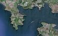
St.Ann's Head; 51:40'.84N 005:10'.42W Edge of Sheep Island: 51:40'.24N 005:07'.5WCharts
Admiralty, 3274, 3275, 1478, 2878, SC5608Rules & Regulations
Give Way to Ships, Designated Dead Slow Areas etc, see textHazards
Tankers and ShippingTidal Data Times & Range
HW = Dover -0500, MHWS 7.0m, MHWN 5.2m, MLWN 2.5m, MLWS 0.7m (links)This site is designed for slower, roaming broadband connections, like you would get at sea, so it needs JavaScript enabled to expand the text.
General Description
Milford Haven is a superb natural harbour (rated highly by no-less than Nelson), and
..... offers the small craft sailor over 25 mile of navigable waters, encompassing facilities from marinas to numerous peaceful anchorages. Entry is possible day and night, and Milford Haven is considered the harbour of refuge.
Much of the petrol and diesel imported into the UK comes through Milford Haven, thus there are liable to be movements of huge ships. This need not be too problematic as the entrance is wide, the big ship channels are well defined, and the yachtsman or motorboater needn't use them.
Even if you don't have time for a thorough exploration, Milford Haven can offer some lovely passage anchorages close to the entrance. If heading South it is possible to wait here for suitable weather to cross the Bristol Channel, without too much of a detour.
If you do have time to explore, you will be well rewarded. Once past the oil terminals and jetties you can enter the River Cleddau, where there are plenty of opportunities for peaceful anchorages that are not dominated by the industrial scene.
Absolutely all kinds of watersports activities are encompassed within this large area, the speedy will find places to speed, jetskiers will find places for their acrobatics, and areas set aside for waterskiing.
Yachtsmen will be delighted that most of the areas suitable for anchoring have been designated as "Dead Slow, No Wash" zones, so they should be able to enjoy their peace and quiet.
Provisioning can be accomplished reasonably easily.
We intend to cover this area with two articles, this first article covers the approach and entry together with possible passage anchorages. The second article covers the marinas, moorings and many further anchorages deeper within.
Approach
Approach and entry to Milford Haven is simple enough,
.... although there are various dangers in the offing that are best seen by reference to our chart of the approaches to Milford Haven.
To the north of the entrance there is Skomer Island, Skolholm Island, Grassholm and The Smalls. With attention to navigation you can pass between Skomer Island (giving it a good offing due to overfalls), and Grassholm. Skolholm likewise needs a good offing to avoid Wild Goose Race.
Most sailors coming or going to Southern Ireland tend to use Broad Sound passing between The Wild Goose races and the Skomer Island Race; coming or going to Fishguard the local sailors all use Jack Sound (some even swear by Litle Sound between Skomer Island and Midland Island in settled weather but I'd have the engine on for that as the wind can turn on the way through and have you all aback in a very confined space!)
Full pilotage details:
If approaching from the South the Mariner needs to be aware of the Castlemartin Firing range and if approaching from the East there are also the Manobier, Penally and Pendine Sands ranges to be considered. Full details of each range, including contact details, can be found at
DTE Pembrokeshire Public Information Leaflet (publishing.service.gov.uk)
The problem is that these four ranges affect the coastal cruiser from Worms Head to Milford Haven and all are potentially active during the working week though you will be glad to hear that, at the weekends, none of them is active. Another problem is that none of the aforementioned ranges talk to each other so that to make a coastal passage on a week day you have to make separate calls to each of them to ascertain whether or not they are planning to be active.
The Ranges (Pembray and Penally) in Carmarthen Bay only really affect passage into harbours in that bay and we will discuss those when dealing with those harbours.
Manobier and Castlemartin are the bugbear for passage making from Culdy Island to Milford. The legality is the same as for all MOD ranges and you have right of passage, the reality is that if every sailor along that coast stood on his "rights" they'd get nothing done so, unless you really are being pressed by tide or weather to make a passage close in, then you should stand out to sea and give them room (remembering that at the weekend they normally pack up and go home).
Manobier is an ground to air missile range and they are firing at targets out at sea; Castlemartin is a ground to ground range with the targets on the cliff edge so the danger is from "overs." Manobier extends 12nm south of Old Castle Head (due west of Caldy Island); Castlemartin is huge, but for practical purposes the south boundary is E/W through the St Govans SCM and the west boundary is N/S through the Turbot Bank WCM.
There are range safety boats working out of Tenby and Milford, the ranges can be contacted on VHF 16 and will contact you on VHF if they deem you to be in the way. The range safety boats will back up any "instructions" given by the RSOs on VHF and are oblivious to the fact that you will loose an hour or more of tide if you follow their instructions.
The moral of the story is that, in order to avoid any hassle, you should make passage at the weekend. In ten years of sailing these waters I was only once an "inconvenience" to them and had to hold to my own rights as I was pushing it to get into a tidal harbour at the end of my trip; I was made well aware of the fact that I was holding up operations and was "shepherded" by a safety boat hard on my quarter bellowing at me through a bull horn.
On the other hand Manorbier range once cleared me through under the cliffs between firings and was very helpful, as the alternative was to go south about Culdy Island and thence way out to sea to go round them.
Milford Haven CG do not include a Gunfax with their Maritime Safety messages but, on a daily basis, are informed by the ranges each morning of the intended activity so a phone call to them before departure is well worth while.
The best plan is to stay outside of the area by passing south of the St Gowan southerly Cardinal buoy (Q(6)+LFl.15s) which marks St Gowen Shoals and tide race. On the other hand the inshore trip past St Govan's Head and inshore of Crow Rock sports some lovely coastal scenery as well as a back eddy on the flood in places so if the weather gods are kind to you take advantage of it.
The Turbot Bank as marked by a westerly Cardinal buoy Turbot Bank (VQ(9)10s) is worth avoiding in breezy weather (esp. wind against tide) by passing outside it. All the areas of tidal disturbances are clearly marked on the chart. In anything other than very settled weather the sea around Linney Head can be quite lumpy and the rhumb line from St Gowans to Sheep Island takes you through those waters; it's best to put in a wee dog leg to seaward to take you through more comfortable seas!
 In the closer approaches to Milford Haven the main tidal stream runs ESE from local high water +0450 and the WNW going stream starts one hour before local high water. These streams can attain 3 kn at Springs. Click on the chartlet to the left to get a zoomable version in a new tab
Once in the entrance the effect of the cross stream is replaced by a simple in and out effect. The tide ebbs out of the entrance from half an hour after local high water reaching 2 knts at Springs. The flood into the harbour begins shortly after local low water and can reach 1.5 kn.
The area where these two streams meet at almost 90° outside of the harbour can give rise to a confused sea.
The two main, big-ship channels are marked on the charts and it is best to stay outwith those. The entrance is wide, and small craft can use the whole width of it. In thick onshore weather, especially with an ebbing tide it is wise to give Chapel Rocks and At.Ann's Head a wide berth to avoid confused seas.
It is extremely likely you will meet big ships using either of these channels, and they are constrained by their drafts. Therefore the narrow channel rules always apply whether under sail or motor, and small craft must keep right out of the way. Also bear in mind visibility from the bridge of the ship is restricted at close quarters, you may be able to see them clearly but if you get too close in front of them they cannot see you.
All small craft must keep a minimum distance of 90 m away from all ships, terminals, and ships at anchor. All ships on the move should be considered as having a moving exclusion zone around them and especially forwards of them.
Milford Haven Port Authority have the overall responsibility for these waters, and they produce a useful guide for small craft showing what is permissible in all the different areas. Download it here:
Enjoy the Waterway (mhpa.co.uk)
Their website also provides local notices to Mariners, and plenty of other information for small craft users. A link is provided below:
Keep listening watch on VHF channel 12 upon approaching the harbour.
The actual entrance is made between St Ann's head to the West (The promontory is topped by a conspicuous lighthouse shown in the photo gallery) and, to the East, Sheep Island at 36 m tall and Rat Island at 23 m tall, lying off Studdock Point and East Blockhouse Point respectively. In the middle lies the appropriately named Middle Channel light structure Fl(3)G.7s18m8M. The East and West channels pass either side of this and are well buoyed, with the West channel being the deeper.
In strong onshore conditions the East Channel is probably the best for small craft, and the shallows over Chapel Rocks and Mid-Channel Rocks should be avoided.
Night entry (a distinct possibility given the local distances and tides) is possible. using the St.Ann's Head Lighthouse (Fl.WR.5s 48m 18/14M) the white sector of which will guide you to the West channel entrance. Red sectors keep you away from Linney Head (although this doesn't totally cover the Turbot Bank).
A set of leading lights can then be picked up, the rear one displayed on Watwick Point, the forward one on West Blockhouse Point. Following these inwards a further set of leading lights can be picked up, the rear one on Little Castle Head (Oc8s53m15M), and the forward one on great Castle Head (Oc.4s27m15M). The characteristics and arrangements are best seen on the charts.
Added to the extensive lit buoyage, these sectored and leading lights make night entry relatively easy, but to save all confusion (as often happens in these situations), it is best to enter a carefully chosen and checked selection of waypoints into your GPS to get you in.
The above instructions for night entry seem easy to follow but the reality is that it is very, very confusing from sea level; notice that the lights on Castle Head ( the last ones you need) have a range of 15 miles and sit nearly 90ft at mean sea level and are of the first you see (even over the land at East Blockhouse point as you come over Freshwater Bay) Be very careful to indentify which lights you are looking at by checking the light signatures (This is one harbour that I would now make out a black felt tip on white paper light plan for, before departure; it's not one to blunder into unprepared, as I did!)
Once inside make for your choice of Anchorage or Marina, many boats go straight to Dale just within the entrance to the North.
Berthing, Mooring & Anchoring
This article only covers the passage anchorages near the entrance, and
..... we have provided a chartlet for each one. Dale Anchorage, Sandy Haven Bay, and Angle Bay.
The Dale Anchorage
This Anchorage provides good shelter in all winds that do not have an easterly component. Easterlies have a big fetch. Nose into the bay and anchor to suit your draft and wind conditions. South-westerlies are best dealt with by anchoring tucked under Dale Point, while winds with northerly components can be dealt with by anchoring closer to the northern shore.
The whole area within, as marked by the yellow buoys, is designated as a quiet area with a dead slow no wash speed limit (much to the relief of those at anchor or on moorings)
The bay shelves gently and steadily and in summer pontoons for visitors are established on the 2 m line (NB that pontoon is nearly half a mile from the landing slip). Fresh water is piped to the inner of these pontoons. Anchor outside of local moorings. Early and late in the season or midweek if bilge keeled it may be possible to berth alongside the pontoon depending on how busy it is.
Ashore you will find a friendly yacht club and the small village. If intending to make use of the YC showers you would be advised to contact them in advance.
Dale Yacht Club – Friendly sailing in Pembrokeshire (daleyc.co.uk)
Sandy Haven Bay
This Anchorage is good for winds from the north-west through north to east. It lies a couple of miles to the east of the Dale Anchorage. Again it is simply a matter of sounding your way in carefully and anchoring outside of the local moorings.
Attention needs to paid to the drying Bull Rocks which lie about a cable off Little Castle Head. There are also other rocky patches to take note of should you be planning to nose your boat in and dry out on the sandy beach.
There are no facilities ashore here, and you will need to move (not far) if the wind springs up hard from the South.
Angle Bay
Angle Bay on the South side can provide shelter from winds with a southerly component. The bay is wide but shallow, much of it dries out and there are many rocky patches.
Boats wishing to remain afloat can anchor in the region of the lifeboat slipway, whilst skippers of shoal draft craft with a yen to explore can nose into the Bay fairly close to Angle Point and anchor somewhere near the local moorings. At neaps it may be possible to remain afloat here, otherwise be prepared to take the ground and very aware of the unmarked rocky patches. Be very aware that the bottom here is very muddy and you can be marooned aboard or ashore at low water.
If you make a landing you will find the small village of Angle close by.
Facilities
If you get ashore at the Dale Anchorage you will find a friendly yacht club with a dinghy and cruiser section, The Dale Yacht Club. The club has its own restaurant. We've provided a link to their website below:
Limited supplies are available ashore, with a local shop and post office. A waterside pub completes the picture here. Since we first started coming here Dale has developed a bit more of a holiday village - there is now a water sports place on the shore which is very lively and the link below gives more information about the village:
The only transport link to Dale is a twice daily bus service to Milford and Haverford West in the summer (it used to be twice weekly!)
No facilities are available at Sandy Haven, while if you get ashore at Angle you will find the small village there has a post office and a pub serving food.
History
Milford Haven (Welsh: Aberdaugleddau, meaning "mouth of the two Rivers Cleddau") is a town in Pembrokeshire, Wales on the north side of the inlet of the same name. Founded as a whaling centre in the 18th century, the town's port is one of the largest in the United Kingdom in terms of tonnage and plays an important role in the United Kingdom's energy sector with several oil refineries and one of the biggest LNG terminals in the world. Milford Haven is the second largest settlement in Pembrokeshire, with a population of 13,100; though its community boundaries make it the most populous in the county, with 13,096 people.
Early history
From the 790s until the Norman Invasion in 1066, the waterway was used occasionally by Vikings looking for shelter. During one visit in 854, the Viking Chieftain Hubba wintered in the Haven with 23 ships, eventually lending his name to the district of Hubberston. A Benedictine priory was established at the head of Hubberston Pill in 1170. Founded by Adam de Rupe, it stood until the Dissolution under Henry VIII. St Thomas a Becket chapel was dedicated in 1180, a structure which looked out over the Haven from the north shore of the town.
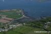
View of Milford Haven Docks from Hakin
In later years it was used as a beacon for sailors in foul weather. The area however was a source of anxiety for the Tudor monarchy. Due to its location, it was exposed to attacks from Ireland, a convenient base from which England could be invaded via Wales. In 1405, the French landed in force having left Brest in July with more than twenty-eight hundred knights and men-at-arms led by Jean de Rieux, the Marshal of France, in order to support Owain Glyndwr's rebellion. By the late 1700's, the two creeks which would delimit the future town of Milford's boundaries to the east and west, namely Hakin and Castle Pill, were being used as harbours for ships to load and unload coal, corn and limestone.
See the history section attached to the Milford Haven 2 Article for more details.
The text on this HISTORY page is covered by the following licence
http://en.wikipedia.org/wiki/Wikipedia:Text_of_the_GNU_Free_Documentation_License
Eating, Drinking & Entertainment
There are pubs at Dale and at Angle, both serve food. If you are looking for a bigger choice you will have to move further, into Milford Haven itself; which is an expensive taxi journey away.
Links
|

Got a comment to make about Milford Haven ? Have you found this coverage helpful ? HAVE YOUR SAY (your email address will always be kept private)
Your Ratings & Comments
Nothing was marked on the chart, but we noticed some buoys in the water - probably lobster pots - then a power pylon on the shore side.
We turned around at the last minute as didn't like the look of it and it turns out there is a wire strung across from the mainland. Reading the notes in Tom Bennet's "Sea Guide to Pembrokeshire" it says this is not recommended for boats over 10m, but I would simply avoid this route if you have a mast.
Editors note: Overhead cable is shown on UKHO raster charts, clearance 14m
The moorings are in an area that nearly dries on a low spring tide but are generally usable by shallower draft boats.
If you depart from Dale about High Water you should make the Jack by slack water if you dont allow your speed of advance drop below about four and a half knots. Just follow the Imray directions and it is a piece of cake. If you are trying to make it round to Fishguard in one hit it is necessary to go through the Jack about an hour before slack - keep the speed up and you can go through Ramsay at slack water. I have only attempted it once under sail and that was on a very settled day with the breeze from the Sou'East - gybed through the Jack, went across St Bride's Bay under spinnaker and found that the Ramsay was so settled that I went through that under spinnaker - but that was an exceptional sail - they only come along every so often and are unforgettable - best go through the sounds under power - or at least with the engine at a moments notice.
The reverse trip is not possible from the North as Ramsay Sound Slack water is an hour before The Jack - but a little way along St Brides is Solva - lovely little place - so an afternoon sail through Ramsay Sound followed by a convivial evening at The Ship for a morning start for the Jack can be recommended