You are viewing the expanded version of this Harbour,
for faster browsing
use the regular version here


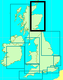
Stromness and Scapa Flow
Courtesy Flag
Flag, Red EnsignWaypoint
None givenCharts
AC 1954 Cape Wrath to Pentland Firth including the Orkneys; AC 2162 Pentland Firth and Approaches; AC 0035 Scapa Flow and Approaches; AC 2250 Orkneys Eastern Sheet; AC 2249 Orkneys Western Sheet; AC 2568-1 Stromness and Hoy Sound; AC 2568-3 Houton Bay; C68 (Imray) Cape Wrath to Wick & the OrkneyRules & Regulations
None, but all ferries and large ships report their movements to Orkney VTS on VHFHazards
Strong tidal streamsTidal Data Times & Range
HW Stromness is between 0235 and 0135 before HW Wick. MHWS 3.6m MHWN 2.7m MLWN 1.4m MLWS 0.7m HW St Mary’s (Scapa Flow) is 0140 before HW Wick. MHWS 3.3m MHWN 2.6m MLWN 1.4m MLWS 0.6m HW Pentland Firth is 0025 before HW Wick (links)This site is designed for slower, roaming broadband connections, like you would get at sea, so it needs JavaScript enabled to expand the text.
General Description
Contacts
Orkney VTS (0)1856 873636 VHF 11
Stromness Harbour 01856 850744 VHF 14
Stromness Marina 07483 366655. Office (HO only in Kirkwall) 01856 871313
Telephone numbers for the HMs of the smaller harbours published in the Clyde Cruising Club notes are sometimes historical; the one for Long Hope is definitely wrong but that for St Margaret’s Hope 01856 831454 is good (except he’s retired and it’s his son that is the HM!)
Useful additional information about the harbours around the Orkneys can be found at www.orkneymarinas.co.uk and you can download their handbook which covers absolutley everything, including local tidal streams,
One view of the Orkneys is as a place of legend, mystery, strong winds and vicious tidal races and for others it is adventure, idyllic memories and some super sailing. In fact it is a mixture of all these things. Most people are surprised when they get here; pre conceptions are blown away because, apart from Hoy, most of the islands are low lying, there isn’t the grandeur of the Scottish wilderness further South. Great swathes of the islands are cultivated because, although the growing season is shorter than on mainland UK, daylight hours during the summer last from half three in the morning to ten, eleven o’clock at night. One thing that is missing though are trees and those that do exist are bent over like smoke from a factory chimney!
From the cruising sailor's point ov view the Orkneys can be divided into the Southern and Northern “halves”; the Northern half (the “Northern Isles”) have Kirkwall as their main town and the Southern half which includes the larger “mainland” of Orkney, Hoy and South Ronaldsay having Stromness as its main town (though buses between Kirkwall and Stromness are very regular). This article deals with the Southern Half and the stretch of water known as Scapa Flow.
Most of the older generation of sailors will be familiar with Scapa Flow as the anchorage in which Beattie was holed up with his Grand Fleet during the First World War and where the German Fleet was scuttled at the end of that war. The Fleet was based here again during the Second World War when the Bismarck was hounded through the straights into the Atlantic where the Gibraltar Fleet finally managed to wound her and subsequently pound her to death.
It was here that a German submarine managed to penetrate the defences and sink the Royal Oak at the beginning of the war which resulted in the “Churchill Barriers” (Note for younger sailors, a guy called Winston Churchill was in charge of “our side” during the Second World War!) which still block all the previously useful channels into and out of the east side of Scapa Flow. This necessitates a long diversion round South Ronaldsay if sailing from Scapa to Kirkwall.
All that is history now although one can still bump into “pill boxes” and other reinforced defences around the shores of Scapa Flow (but they are mainly overgrown or camouflaged by lichens).
Of course, long before that, these islands were the main base for the Vikings on this side of the North Sea; they colonised the islands and used them as a base for raiding the rest of UK and Ireland. There have been extensive archeological explorations of the Viking habitations on the islands and for those interested in them a visit to https://www.orkney.com/things/history/viking-heritage gives a good overall view of what there is to see. (A point to note here is that all the cruise ships plying these islands send bus loads of people to the main sites so plan your visit to avoid them! Whic, in 2018, is becoming increasingly difficult)
Today the islands are mainly agricultural with the added boost of North Sea exploration and, nowadays, tourism (which, of course, includes us the wandering seamen). This will be immediately apparent when you clock in with the marina supervisor who, as well as taking your money, will provide you with a huge pack of information on the Orkneys, things to see and a copy of the Orkney Ports Handbook giving all the main anchorages and piers. For this article we have compiled and shown most of the available anchorages in and around Scapa Flow on our Google link below.
Whilst talking of available information we should mention that, if you are intending to sail these waters, get a copy of the Clyde Sailing Club’s Sailing Directions (www.clyde.org); you will find it invaluable.
The main anchorages around Scapa Flow starting as you come through Hoxa Sound are Longhope to port and Widewall Bay to starboard; once you have passed through Hoxa Sound over to starboard are the anchorages at St Margaret’s Hope and Burray on Water Sound and, to the North of that, Saint Marys.
Dead ahead on the northern side of Scapa Flow is Scapa Bay itself and then working West along the South Coast of the Orkney “Mainland” are Waulkmill Bay and Swanbister Bay before you get to Houton Bay (which has it’s own Admiralty chart).
Further North West towards Stromness there is the Bay of Ireland and Cairston Road. On Hoy there are several little bays which look as though they might be quiet little anchorages and certainly the two bays inside Rysa Sound have been recommended to us.
It depends mainly on the wind and the weather where you decide to clew up for either lunch or the night; other than Stromness, Scapa Bay, Saint Mary’s, St Margaret’s Hope, Longhope & Houton are probably the best for overnight. If you have sailed in the Scilly Isles it’s very much like that (minus about 10°C!), you potter around and can get limited supplies at some of the anchorages and for the rest you retire to Stromness (and pay the mooring fees!)
Approach
Longhope. There are several approaches to Longhope depending on where you start from;
......coming up from Wick you skirt round the North end of Swoma on the ebb (the swirls are out to the West on the ebb) and make for Switha. It is worth noting that you are unlikely to be able to distinguish Hoy, Switha and Flotta from each other at this stage but you will be able to see the aero generator on the top of Flotta, so initially make for that.
If you have passed Duncansby at slack water then, at some stage between Swoma and Switha you’ll run into the stream coming out of Hoxa Sound; that stream runs anti clockwise around Switha so you takes your choice; go up to Switha Sound, which narrows your angle on the adverse tide but puts it in your favour running towards Longhope through Switha Sound or broaden your angle on the tide towards Cantick Sound and run slap into the flow coming out of there.
On a Spring tide and west wind go the extra half a mile round Switha because a combination of wind and tidal stream through Cantick and the overfalls will knock back your speed quite considerably. Coming down from Stromness or the Nor’west either Gutter Sound or West Weddel Sound is acceptable but if using Gutter Sound watch out for the fish farm behind Fara. You’ll be on VHF 11 so will know of the Ferry movements around Lyness, Flotta, Houton and Longhope; they will give way to you under sail, but only just! (it’s a good idea to familiarise yourself with the layout of Scapa Flow in this respect so that that the R/T calls from the ferries make sense to you)
When you do get up the Sound to Longhope the current which is quite weak until you get to the narrows at Longhope increases so be aware that you can be carried quite a way as you clear away your sails to motor in (a crew is a useful addition to the yacht’s inventory at this stage!) You may find room to berth alongside or you can anchor/pick up a buoy outside.
There’s meant to be a couple of visitors buoys there but they tend to wait until June before they put them out. The buoys that are in evidence early in the season are an unknown quantity so it’s up to you whether you use them or ride to an anchor.
Widewall Bay. This bay is on the East side of Hoxa sound and provides shelter from Easterly seas (the land is quite low so, although sheltered from the sea, it is not completely sheltered from the wind). The entrance poses no problems but is unlit at night. Anchor off the slip at Herston or, if shallow draft, further into the bay in the Oyce of Herston.
St Margaret’s Hope. By Orkney standards this is quite a large village. It is the terminus for the Ferry from Gills bay on the Scottish Coast and is well lit for night entry. Again, if you’ve passed Duncansby at Slack water you will encounter the outgoing stream in Hoxa Sound but this is only a knot at its peak so not too bad. Give Needle Point (on the western side of the entrance to St Margaret’s Hope) a good offing, rounding into the bay outside the green beacon. Anchor in the middle of the bay or, if there is room, alongside the North side of the Ferry pier on the west side.
Burray. This is further up Water Sound past St Margaret’s Hope. It has a drying pier and one can anchor in the small bay to the east of the village. It is possible to lie against the outer end of the pier but you are likely to find local fishing boats occupying that point. Don’t anchor too close to the barrier as the bottom may be foul, and, of course steer clear of the submarine cables.
St Mary’s. This anchorage is on the northern side of Kirk Sound; there is a slip/pier and if you can take the ground you can tie up to the pier. There is a visitor’s buoy in the bay but you may want to anchor closer in. Avoid anchoring close to the Churchill Barrier as there are still the remains of the block ships laid in WWII on the bottom waiting to grab a hold of your anchor!
Scapa Bay. This poses little problems apart from the bunch of rocks on its west side (the Scapa Skerry) which are marked by a red, lit PHM. Although there is a substantial pier it is completely utilised by commercial boats (some of which are on constant standby for oil spillages) and anyway its piers make it unsuitable for yachts. There is a red visitor’s buoy in the middle of the bay to the north of the pier; it’s quite a substantial affair and well able to take two yachts rafted together.
There is a note on the chart giving the Cathedral at Kirkwall and a white house on the shore as leading marks to avoid the Skerry rocks; that’s all very well in good visibility, in bad vis you might find the transit between the Orkney VTS building (with its flagpole) and the end of the pier equally viable and, anyway, once you have cleared the Skerry buoy just head straight for the mooring buoy. If you have any doubt about which buoy to pick up the watchman in the VTS tower (who will be observing your manoeuvrings with a nautical eye) will put you right.
Houton (Bay of) is a useful little anchorage having a narrow entrance and reasonable depth. It is a base for the ferry from the “mainland” out to Lyness, Flotta and Longhope so the navigational buoyage is well maintained as are the leading marks on its West shore.
There are several private moorings to the SW of the ferry terminal as well as a large grey buoy which was put there for the salmon fisheries but has not been used for several years. There are also some private buoys to the SSE of the terminal. In fact some of the private buoys are duplicates for the same owners (professional fishermen) who favour the SSE ones as being closer to the slip on the East shore (where they land their catches) but like to move further into the bay in adverse weather conditions.
If you are lucky you may be able to use one of the buoys to the SW if the owner is not using it at the time (obviously ask permission). As the entrance is narrow (dredged to 3m for 15m either side of the leading bearing), make use of the leading marks and skirt round the SHM when through the entrance.
Your difficulty in selecting an anchorage (or buoy) is working out how much water there will be at LW, especially at Springs. The other problem is that, if you drop your pick where the little anchor is shown on AC 2568-3, you’ll be slap in the way of the ferry’s approach to the pier and will have a very disturbed time. We think that if you are a shallow draft bilge keeler you should have no problems at any state of the tide but if you are a keel boat with a draft in excess of 1.5m you would probably be better advised to give this bay a miss at Spring tides.
Stromness. If you are exploring Scapa Flow (or just passing through) you will inevitably want to drop into Stromness at some stage, if only to bunker or reprovision. You will have to do some sums as the harbour is up at the narrow, Northwest end of Scapa Flow and at Spring tides there can be quite strong (in the case of Hoy Sound, very strong) currents past its entrance. You will naturally consult the tidal streams atlas (available free at our page http://www.visitmyharbour.com/articles/?caturn=842 )
But remember that these shows streams in the main channels, not every little swirl and eddy (of which there are many) and also that the buoyage is laid out for large commercial vessels, you do not have to stay within the limits of those channels in a 1.5m draft boat! You will note that in our photo “Hoy Sound (High) light house…” the Peter Skerry SHM is out on the port bow; that is because we found a back eddy up that part of the coast at a time when the tidal Atlas was giving a 4 knot adverse stream.
Mind you, be careful of who you take advice from, most of the locals navigate these waters in craft with stonking great diesel engines so going against the stream merely takes a little longer – not all morning as it does with some of us little boats!! We have always gone round to the East of the Riddock Shoal and Sand Eel (off Hoy Sound (High) lighthouse) but there is also a straight line route between those shallows and Graemsay Island which we haven’t tried (mainly because the surface patterns indicated some quite strong eddies so we chickened out, and all the boats around us did as well!).
From the South East the entrance to Stromness is not at all obvious from a distance of about 3 miles but gradually becomes identifiable. As soon as you can, pick out a couple of points (one on the shore and the other, one of the houses up on the hill behind the town) and shape your course to keep them in some sort of transit; in this way you will avoid the temptation of “pointing” straight at the town and being swept past on the tide. (You will find that you will have to toe off quite a bit to hold your chosen transit).
From the West or North the passage through Hoy Sound is much more ticklish because of the strength of the currents (up to 8kts springs) and the overfalls they can produce. You should avoid wind over tide conditions and try to plan your passage an hour either side of slack water in either direction. (East going stream begins at 0530 after HW Dover and the West going 0110 before HW Dover).
From the North, come inside the Wave Test Site and hold South wards on the 20m contour until Breck Ness is up to the NE and then follow the 10m contour into the Sound staying well outside the green sector of the Skerry of Ness WG light. It’s safe to turn in for the harbour when the SHM opposite the Outer Holm becomes well open to the right of the PHM in the harbour entrance. Note that, at night, there are four different red pierhead lights (with different signatures) within the harbour and only two greens (the SHM at the Outer Holm and the SHM opposite the North Pier) – your best bet is to ignore the reds and shape a course straight between the two greens and then round the last red into the Marina.
Update There is now the light on the end of the newish pier (2F.G vert) so you can get some sort of transit when the Outer Holm buoy comes into line with that.
The marina is at the far end of the inlet past the Orkney Ferry pier and you should call the HM on VHF 12 for information on its movements.
Berthing, Mooring & Anchoring
Stromness is the only place around Scapa Flow where there is any semblance of order to berthing;
The visitor’s berths are those on the South side of the Southernmost pontoon and the refuelling berth is at the innermost end of that rank (so to be avoided). There is a chartlet of the layout, with depths, in our Navigation Images gallery.

They are good, long fingered berths but do not have cleats to tie to, there are metal loops through which you have to pass your warps. (So you will not be able to drop a loop over a cleat as a method of stopping your boat!!!)
There is not a permanent shore presence in the Marina and the HM does not allocate berths; you just select a suitable berth and help yourself (if there is local boat owner around he will undoubtedly stop what he’s doing and give you a hand).
Although the roving HM (he covers Kirkwall as well) will probably turn up at some time during the day and will collect harbour dues it's worth noting that they have an internet site on which you can book and pay harbour dues on line.
http://www.orkneymarinas.co.uk/book-pay/prices
They are charging £2.45 per metre per night (min £18.00) but it's worth noting that this will cover you for all the Local Authority marinas and piers so getting a week's worth at £13.85 per metre is a good saving if you are exploring. But that is only if you intend spending every night at an Authority facility because nights spent at anchor elsewhere are discarded.
A word of caution; the harbour shoals quite a bit to the east of the pontoons so it’s unwise to go swanning around there to adjust your approach, especially at low water. Elsewhere the available spots for anchoring have been mentioned in the text above.
Facilities
Stromness Marina has full facilities; shore power and water on all berths; showers, toilets and laundrette in the Ferry Terminal (quite a hike so don’t leave it too late!) There is diesel fuel available by hose and Petrol at the garage (quarter of a mile inland). That garage also stocks both Gas and Gaz. Next to the garage is a reasonable sized Co-op supermarket. The town itself has three pub/hotels and several good restaurants and a plethora of tourist type shops/galleries. The library has a couple of computer terminals with internet access. Brilliant place altogether. On the pontoons be careful to turn off water hoses when not in use; they have a complicated bit of wizardry which turns off the water completely to the whole marina if it senses a “leak” The marina superintendent appears once a day (twice in the high season) to accept your harbour dues and give advice and he is available on his mobile pretty well 24/7
Longhope has a shop, showers and toilets (in the Life boat building) and expensive auto diesel and petrol (by cans). No shore power but water from a tap on the quay.
St Margaret’s Hope. As has been said, this is quite a large village and has a Post Office/ Store and several other shops. Water can be obtained at the Ro-Ro pier. There is a garage but it is out on the main road and you’d need a lift to it
Burray has a pier and boatyard with a Post Office, shop but no garage (it’s closed)
St Marys. Here there is a Post Office, shop but again the garage that was here has ceased trading.
Eating, Drinking & Entertainment
Hotels/pubs at Stromness, Long Hope, St Margaret’s Hope, St Marys and Burray Village.
For entertainment see the multitude of attractions on the http://www.visitorkney.com/ website. We can recommend the last weekend in May at Stromness for the Orkney Folk Festival.
Links
|

Your Ratings & Comments
It was getting dark when I arrived so anchored off the Inner Holm for a few hours rest until I could see to get into the marina. It can get shallow at low water in places so care is needed.
The town in very busy when the ferry arrives but soon quietens down when it leaves. There is a chandler, super butchers and the all important gas shop at the garage on the edge of town.
Beware of potential vertical wind off the West side of Hoy if you leave westbound. With the wind strong from the south east this can be quite a handful until you get clear.