You are viewing the expanded version of this Harbour,
for faster browsing
use the regular version here


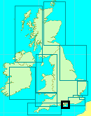
Wootton Creek
Courtesy Flag
Flag, Red EnsignWaypoint
Wootton Beacon 50:44'.53N 001:12'.13WCharts
Admiralty 2022, 2036, SC5600Rules & Regulations
5 Knts Speed Limit (QHM Portsmouth Order)Hazards
Wootton Rocks, Ferries, Drying CreekTidal Data Times & Range
HW +0014 Dover, Long Stand MHWS 4.5m, MHWN 3.7m, MLWN 1.9m, MLWS 0.7m (links)This site is designed for slower, roaming broadband connections, like you would get at sea, so it needs JavaScript enabled to expand the text.
General Description
Fishbourne at the entrance to Wootton Creek is the main car ferry terminal for the Isle of Wight.
Virtually right alongside the ferries lies the Royal Victoria Yacht Club and from this area Wootton Creek winds inland for about half a mile as far as Wootton Bridge. Although there is obviously a deep channel for the ferries, once past the terminal the Creek dries out rapidly.
The area around the Royal Victoria yacht club offers shelter for shoal draft craft in anything but strong winds from the North to the East quadrant.
Even near the entrance deep draft craft will be unable to lie afloat at all states of the tide.
We don't have many useful photos of this Creek as yet, but in this case the Google interactive tour provides exceptionally good clarity. More relevant photos would be welcomed.
The Ferry Terminal is owned and run by Wightlink, but the creek itself comes under the jurisdiction of the Queen's Harbour Master Portsmouth, with the Wootton Fairway Assn. given responsibility for keeping the fairway clear.
Approach
For the yachtsman or motorboater, approach from the West involves keeping a decent offing to avoid running up Wootton Rocks,...
lying approximately 300 m to the north-east of Wootton Point.
The tall ship Marjorie ended up stranding here in August 2007. Keeping offshore of the Royal Victoria Yacht Club's starting platform will clear these, and they are marked by a red beacon also, but this is virtually on top of them. See full pilotage details:
From the East there are no real hazards other than keeping well clear of Ryde Sands, and the northerly approach has plenty of deep water. The biggest hazards are the ferries and a quick study of their behaviour will pay off. When one is leaving there is very often another lurking around waiting to go in.... once this is in it has to disgorge and refill, which gives you around 20 minutes to negotiate the short channel without problems. There is really not enough room at low water for you and a ferry at the same time. Conversely when leaving it is best to wait until the incoming ferry has berthed, thus giving you a clear channel outwards.
From the northerly Cardinal Wootton beacon (Q) locate the very clear red and green posts showing the way in. These are all lit and will take you as far as the conspicuous ferry terminal. Further aid at night is given by the narrow white sector of the Oc.WRG 10s sectored light mounted on the shore by the ferry terminal.
Once past the green post number seven and virtually abeam of the terminal, swing to starboard leaving the yacht club pontoon on your port side. A pair of small red and green buoys show the deepest water.
If intending to delve deeper into the creek itself a westerly heading from here, try to pick up the leading marks consisting of a pair of triangles on the western shore. These line up with the best water, and continue on this line until you can locate and pass the small green buoy (which should be ahead) closely on your starboard side. The best water is very close to this buoy, and a spit runs out towards it from the south-eastern shore. A swing to port is now made and a small red buoy is left on your port hand side. This together with a line of piles to port leads towards Fishbourne Quay, a small industrial area with a specialist aluminium boatbuilder (now believed defunct, area awaiting re-development).
Once past this boatyard a small green buoy looking like it's on the wrong side of the creek really does need to be left close on your starboard side, and from here on the deepest water lays fairly centrally as far as Wootton Bridge.
As they say a picture paints a thousand words. This video gives a good view of the whole of Wootton Creek. Notice that the Buoys on the UKHO chart have beenreplaced by piles.
Berthing, Mooring & Anchoring
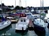
About the only place to tie up is the Royal Victoria; they specifically welcome visitors both to their pontoon and club house.
In 2015 the ownership of the yacht club pontoon changed and the outer half of the pontoon is now privately owned. There is a visible sign showing where one begins and the other ends but until then the section belonging to the RVYC has piles with white caps on top and there is a line painted on the pontoon! Give them a ring on the number below to book a slot on the pontoon - essential on busy weekends or if intending to bring half your yacht club with you!
They charge £2.00 per metre per night for this with short stays at £5.00. Water is available here but no shore power. Anchoring and drying out is possible deeper within, but it is not allowed to anchor in the entrance near the club. Nipping up the creek at HW to the Sloop Inn is possible.
The Yacht Club welcomes visiting yachtsman from other clubs to use its facilities including showers and toilets. They ask that you contact them by email to book a slot in advance and give bank details for payment by BACS. The club is closed on Mondays but otherwise there is a bar providing meals and drinks. The bar is open at lunchtimes until five every day but only on Wednesday and Friday evenings. Food is available every day until three and again on Wednesday and Friday evenings. Telephone them on 01983 882325, or link to website below:(which is one of the few Yacht Club with an extensive tab for visitors)
 The intrepid gunk holer working his way into the Creek should be aware that the channel must be kept clear, and anchoring is not allowed on the Western side. The eastern side of the creek is privately owned by the adjacent businesses and residents, so again anchoring is impossible.
A high water it should be possible to reach the head of navigation at Wootton Bridge, and haul your dinghy up the slipway and visit the Sloop Pub.
On the eastern bank by Wooton Bridge, the boatyard at East Quay offering drying moorings to local boats, and some repair facilities has now been replaced by an upmarket estate agents. Such are the times in 2010.
The other boatyard at Fishbourne Quay (shown on the Admiralty chart as coming up just after the RVYC upon entering the creek) has been developed into units for "maritime related commerce" and has no facilities for visiting yachtsmen though, in the future, it may happen that one of the businesses there will be invloved in the sort of stuff we need. Basically there are now no facilities for a visiting small craft within Wootton Creek itself, and no fuel available.
Facilities
At Fishbourne by the yacht club there is nothing other than one pub. A determined hike from here, (or a dighy mission on the tide to Wootton Bridge for less walking), will bring you to The Sloop Inn.
From this area if you walk towards Newport up the hill you will find first on the left hand side a launderette. The next little parade on the LH side offers a Chinese takeaway, Indian takeaway, chip shop and chemist. More or less opposite this parade (RH side) is a Tesco's Metro (with cash machine) and a Majestic Wine Warehouse. A Spar store with a post office is further 350metres up the hill."
Transport from the area is covered by Southern Vectis buses from Wootton Bridge towards Ryde and Newport, and of course the Wightlink Ferries from Fishbourne that go straight to Portsmouth and meet up directly with the mainline rail services for London and elsewhere.
Eating, Drinking & Entertainment
The Royal Victoria Yacht Club offers simple bar meals but is closed on Mondays. Nearby is the Fishbourne Inn with restaurant and gardens.
At Wootton Bridge is the Sloop Inn with a large value for money restaurant, in really pretty surroundings complete with gardens. This pub periodically gets flooded and has to close for refitting. A dingy mission here on the tide will be worthwhile.
Notes from member Gary Flashman:
Wooton Creek
Fishbourne is the destination for the Portsmouth car ferry, so although the main channel is dredged you must be aware of ferry movements. Look out for them as you approach and keep close to the piles, just outside the channel if one is manoeuvring.
Royal Vic
Tel 01983 882325
RVYC.org.uk
The Royal Victoria Yacht Club sounds as though you ought to wear your best whites, an approved club tie, and bend a knee on entering. Nothing could be further from the truth. They welcome visitors and are one of the friendliest clubs you’re likely to find.
Their history is interesting. It seems Prince Albert was a very keen yachtsman and was to be met in all the best clubs. However. All the best clubs were, of course, men only so the Prince Consort couldn’t invite his wife, the Queen and Empress Victoria to join him for lunch.
So they built their own club in Ryde.
One thing led to another and now the RVYC enjoys a lovely location, a great clubhouse now relocated to Fishbourne and a very active membership. Access is 3 hours either side of high water (check with the steward before you arrive) and visitors can moor alongside the pontoon. Space is limited (first come first served) and you need to be able to dry into soft mud, plus you will be exposed to strong winds with any significant North in them. Only the Southern end of the pontoon (closest to the club) belongs to them, the rest is private. Look out for the notices on the piles.
Nonetheless it’s well worth doing if you can. The club is very friendly, boasts an excellent bar with a selection of well kept ales, a kitchen which in itself justifies a visit, and a lovely outlook.
The Fishbourne
Tel 01983 882823
Thefishbourne.co.uk
A short stroll from the ferry terminal is the Fishbourne, a large pub geared mainly to tourists. It has a large garden area, reasonable ales and a competent kitchen. They offer accommodation.
Quarr Abbey
Quarrabbey.org
A half hour walk along a lovely path through woodlands brings you to Quarr Abbey. An active monastery, you can spend a very pleasant morning strolling through the grounds, admiring the buildings and visiting the farm shop.
And of course the pigs. You walk right up to their pens, a particular delight for youngsters. The Abbey have a great scheme, you buy packets of food and feed the animals yourself. You (and especially the kids) have a whale of a time while the monks recover at least some of the cost of feed.
A major plus is the wildlife. The Island is one of the few places in the UK where you can see red squirrels and delightful they are. You are also likely to see birds of prey to say nothing of sea birds of all descriptions.
You can carry on along the same footpath to Ryde, a very pleasant walk through woodland and alongside the golf course.
Links
Very interesting site dealing with the Wootton Bridge area, much historical information and old photos in a state of the art interface. Well worth a look.
http://www.woottonbridgeiow.org.uk/
|

Your Ratings & Comments
But not at the same time.
My companion and I were privileged (if that's the word) to be served the first meal by the new caterers at RVYC a couple of weeks ago. Not a patch on the old Sunday roasts and Wednesday pies but an adequate pub menu, well cooked and presented. And my first draught pint for over a year, of excellent Yachtsman bitter, bought for me by the Commodore. The club maintains its excellent reputation.
A good idea to phone up beforehand to check there'll be room on the pontoon.