You are viewing the expanded version of this Harbour,
for faster browsing
use the regular version here
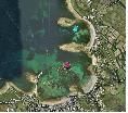
The Scilly Islands, St Mary’s Pool and Porth Cressa
Courtesy Flag
Flag, Red EnsignWaypoint
None GivenCharts
Isles of Scilly; 883 Isles of Scilly and the Principal Off-Islands; SC 5603 (8 to 13)Rules & Regulations
See TextHazards
See TextTidal Data Times & Range
HW St Mary’s is HW Dover – 0630. MHWS 5.7m MHWN 4.3m MLWN 2.0m MLWS 0.7m There is a tidal stream diagram included with the charts of the Islands. (links)This site is designed for slower, roaming broadband connections, like you would get at sea, so it needs JavaScript enabled to expand the text.
General Description
Main coverage of the Scilly Isles HERE Contacts
St Mary's Harbour Office tel 01720 422768 mob 07789 273626 www.stmarys-harbour.co.uk/
Hugh Town is the main administrative centre on the Islands and is also the main location for all the services. It lies on the western side of the Island of St Mary’s and spreads across the isthmus connecting the island to Garrison Hill and can be accessed easily from either St Mary’s Pool to the North of the isthmus or Porth Cressa to the South.
Unsurprisingly most first time visitors head for St Mary’s Pool where there are visitor’s moorings and, at some time during the day, you can get alongside the pier to take on fuel and water. If you are lucky there may be room at one of the three visitor’s berths alongside the inner end of the quay where there are power and water hook-ups but these are drying berths and if you don’t have to raft up with a boat already alongside, you will undoubtedly be rafted upon by the end of the day!
At the height of the season whatever mooring or berth you clew up at you are likely to have to share it as this is a very crowded anchorage, so much so that space to tie up your dinghy is at a premium (do the math; 38 moorings, some double banked, all trying to tie their dinghies up at the steps on the quay; getting back to your dinghy is like trying to stand up on a floating, bouncy castle); some crafty skippers tie a small angel on their painters then, as the tide rises instead of floating away from the ladder the angel sinks next to the ladder as the others float away! This traffic jam may have been solved by the introduction of a pontoon with fingers
The quay itself is holy ground and not to be approached by humble yachtsmen without the express permission of the HM and, even then, not to the disadvantage of the local ferries and various pleasure craft going about their business. The “Great White Whale” (the MV Scillonian) arrives at about lunchtime every day and ties up starboard side to at the business end of the quay and then reverses out again at 2.00pm needing the water to the west of the Lifeboat to turn in before heading back to Penzance. Her normal route is South about the island but she sometimes use Crow Sound.
On the other hand, there’s Porth Cressa, the favoured haunt of those “in the know”. This bay is less used than St Mary's on the other side and, not only that, you can anchor here for nothing. I anchored here in the nineties with a metre draft and laid to two anchors at the bow quite close in (dried out at LW)
Approach
The initial part of the south about approach to both Porth Cressa and....
....St Mary’s is the same and, once you are certain of the position of the Gilstone (unmarked) and it’s associated shallows off Old Town Bay, you can pass quite close Peninnis Head, hold a westerly course until Inner Head is well abaft the beam and then, for St Mary’s, shape a course for the Woolpack SCM or turn in for Porth Cressa. Abnormally, coming into Porth Cressa, it’s possibly better to do it at low water when all the rocks can be seen and even at LWS there’ll be just over a meter of water where the anchor symbol has been place on the chart. Later when you’ve had a look at the lie of the land, if you can take the ground, you can push up right into the throat of that little channel between Brow Breeze and the rock bank to the west of it, lay two anchors in a Y at the bow to limit your scope and you’ll be well settled for a couple of days.
For St Mary’s, once you have passed the Woolpack SCM, there’s plenty of water for a moderate draft boat to coast around Garrison Hill a couple of cables off the main LW mark; you don’t have to follow the deep draft route all the way out round Woodcock Ledge. Once you have cleared Newman hold on to NE course for a while towards the Bacon Ledge PHM to clear the rocks off Rat Island; there are lead in marks shown on the chart but basically when you have cleared Newman Buoy (Fl.(2) G 5s) you can head straight for the moorings. Note that the old sector light on the pier is no more so, at night, you'll have to pass the Newman buoy and hold until the lead in lights on the shore come on to bearing.
If you have opted to come north about through Crow Sound, once you have cleared Crow Rock itself, your only problem is the narrow passage between The Cow (off Taylor’s Island) and Bacon Ledge. The lead-in marks are quite prominent these days (there was a time when it was a case of “Beach hut? What beach hut”); the tower on the hill behind Hugh Town has always been easy to see and thanks to some diligent work the “White Mark on Shelter” is also fairly obvious. If you are in any doubt consult your compass; you should be running in on a bearing of 151T (variation in 2011 was about 4°W). It might be a bit adventurous for a skipper who is not familiar with the Isles to make a night approach through this route.
Berthing, Mooring & Anchoring
You used to be able dry out on the beach at Porth Mellon away....
.... from the madding crowd but unfortunately that is no longer an option as anchoring is prohibited within the harbour limits. That doesn’t apply to the beach at Porthloo just to the north of the Pool where you can anchor off or dry out but it is a fair old hike to the shops from there.
You would be well advised to visit the St Mary's Harbour website above before you leave Lands End and familiarise yourself with the fiddly bits in the rules about who can do what where on the pier.
The mooring St Mary's Buoys have a sliding scale of charges (2022) but basically it’s £21.00 for boats up to 40ft (Yellow Visitors Buoys) and £26.00 up to 60ft (Green Buoys) with the fourth night free if you pay in advance. The alongside berths are £25.50 (40ft) and £30.60 (60ft) per night. Note also that, if you pop across here from one of the other islands to top up with food, cash or a lunchtime libation (a) you can’t anchor and (b) they’ll charge you £6 for a half day stop. (Anchor in Porth Cressa?)
There are no longer any moorings in Porth Cressa
Facilities
Water at taps in both locations as is Wifi
Links
|
Do you have a comment to make about St Mary's ? Did you find this coverage helpful ? HAVE YOUR SAY (your email address will always be kept private)
Your Ratings & Comments
We then motored round to Porth Cressa which was nearly full of anchored boats, but we managed to find a space to join them. Mainly sandy bottom (although I managed to find a patch of weedy rock the first time) and I was able to watch the anchor dig in. People seem to be anchoring all over the charted cables. Sheltered and pleasant.
There seems to be some measure of 4G coverage on O2 as well, which I'm using to write this.☺
using vodafone and 3 in 2016 there was only a 3G signal
this year 2018 on Vodafone it is 4G. Havent tried any other suppliers.
St. Marys harbour has 36 yellow moorings for yachts up to 40ft (£18.50) and 10 green moorings for 40ft - 60ft (£24.50)


