You are viewing the expanded version of this Marina,
for faster browsing
use the regular version here
Inverness
Courtesy Flag
Flag, Red EnsignWaypoint
None GivenCharts
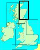
AC 0223 Inner Moray Firth from Dunrobin Point to Buckie AC1077 Approaches to the Cromarty Firth & Inverness Firth AC 1078-0 Inverness Firth AC1078-1Rules & Regulations
Call Inverness Harbour on VHF 12; give way to commercial shipping at all timesHazards
Long sandbank on West side of the entrance which is now marked by a new NCM (See below). Sandbank on East side marked with a lit perch PHM. Strong currents in Kessock Roads (and we mean strong!!)Tidal Data Times & Range
HW Inverness is HW Aberdeen -0120 or HW Invergordon +0010 MHWS 4.6m MHWN 3.6m MLWN 1.7m MLWS 0.8m. Chanonry Narrows Inbound stream starts at HW Aberdeen +0600 (Dover – 0400) Outbound stream starts at HW Aberdeen - 0105 (Dover +0115); There is a slack for about half an hour before the inbound stream at Chanonry Point Kessock Narrows Inbound stream starts at HW Aberdeen + 0535 (Dover - 0430) Outbound stream starts at HW Aberdeen – 0150 (Dover + 0130) . (links)This site is designed for slower, roaming broadband connections, like you would get at sea, so it needs JavaScript enabled to expand the text.
General Description
Contacts
Inverness Marina 01463 220501 VHF 12
Inverness Port Control 01463 715715 VHF # 12
Inverness Marina has been developed over the last three or four years from a creek with a couple of pontoons to what is now a fully fledged, well appointed marina. If you intend visiting this spot you would be well advised to visit their website (link below) to expand on what is written here.
http://www.invernessmarina.com/
The marina is now completely enclosed with a lit, marina entrance on the East side of the River Ness facing WNW (it’s the first thing you come across on the port side after you enter the river). It is virtually a square with two pontoons of fingers down through the middle. They have left nothing out which makes it one of the best equipped marinas in this corner of the world. It is important to note that this marina is open 24/7 whilst the Clachnaharry Sea Lock at the beginning of the Caledonian Canal is closed from 1800 to 0800 during the summer. This means that it is accessible for both flood tides in the summer, given that at the height of the summer it is light from 0430 to 2230; it also means that for departing craft you can catch an early ebb outbound.
Approach
Firstly you must call Inverness Port Control on #12 before entering and leaving the Port
The approach will have you scratching your head and pounding the calculator!!
The problem is that you really need to be in a position about three or four miles away from Fort George halfway through the flood; there’s no point in attempting to peg the tide through the Chanonry Narrows and it will take you a good hour to an hour and a half to make it to the River Ness before the tide turns. On top of that you must allow a bit of time in case the port authority delays you to allow commercial traffic to overtake before the Kessock Bridge.
In future years you might have to start being a bit carefull in the area of the Riff Bank South SCM (in the South Channel approach) as there are massive plans for the developement of the old Ardersier Port which will possibly impact navigation through the South Channel.
Once you have passed through the Chanonry Narrows (and said hello to the dolphins) make for the Munlochy buoy (R/W SWM) which is prominent and easy to pick up, and after that you need to look for the Meikle Mee SHM. Don’t worry if you can’t pick it out at first, just head for the football stadium which is a fairly prominent white building at the SE end of the bridge you’ll pass the Petty Bank PHM off Alturlie Bay and if you look towards football stadium you should be able to see the Meikle Mee green buoy; it is important to leave that to Starboard; seems obvious I know but the Meikle Mee bank extends right out into the middle of the bay so you have to skirt round that buoy before making for the centre span of the bridge.
After that it’s a doddle; pass under the middle span of the bridge keeping quite close to port or even between the tall tower and the first of the piers on the south side of the bridge (there’s plenty of water there) and make for the entry of the River Ness. The reason for staying to port is that you’ll have a fairly strong current under you and if you have to cross it from the North side you’ll be halfway to the Canal entrance before you know it!! If making your approach in the dark (pretty difficult in the summer as there are only about four hours of darkness at that time of year!) the channel is well marked, just make sure that you identify both the Q.R perches on the port side before the Fl.R at the entrance to the Marina (which you may well see before the perches) You will note that there is a Fl R 4s at the near corner of the marina and a Fl R 3s on the next bend; best make sure which is which!!.
There is now a NCM laid to mark the outer end of the bank extending out from Carnac Point on the West side of the entrance to the port. It's position is 57° 29.886’N 004°14.200W and it's a standard NCM BY buoy with a Q flash light at Night and NCM top markings. This NCM is on the Admiralty Chart in our Chart Gallery (top right)
Alternatively you may want to come along the deep channel on the North West side of Inverness Firth after passing Chanonry Point; that’s fine but be aware as you close the Kessock Bridge that there is shallow water between you and the bridge and if you are in any doubt about the depth of the water you should turn South and lay a course to round the Meikle Mee buoy to starboard (remember that the depths over that bank were last surveyed twenty years ago)
The reverse trip is entirely different, especially in a Nor’easter; you’ll be departing on the ebb so it’s shallow and the current plus any wind can set up some quite choppy conditions as you leave the R. Ness. Give the Meikle Bank respect; again it’ll be quite shallow and the currents will set up a chop. Once clear of that bank you are ok to head straight for Fort George and the open sea (saying goodbye to the dolphins this time!)
The other thing to be careful of is, if you are transiting to or from the Caledonian Canal Sea Lock; that bank off Carnac Point (west side of the entrance to the R.Ness) goes out a long, long way. Coming from the Canal is not so bad, just keep well out and head for the bridge when it is just north of east from you and, leaving the new NCM to starboard, turn in when the river entrance is well open on the starboard quarter you can turn back in for it. Going from the Marina to the Canal you must hold on to a NE heading for the bridge until past the new NCM before turning west along the Beauly Firth. After that until the west side of the entrance to the Clachnaharry Sea Lock is opening from the East side it’s not really safe to turn in southwards and you’re best off making a long sweep round to approach that from the WNW. Keep an eye on the echo sounder because it shelves quite rapidly from deep water to no water on the Southern edge of the Kessock Roads.
Berthing, Mooring & Anchoring
The visitor’s berths are on the hammer head right opposite the entrance to the marina....
.......it’s not difficult unless there is a strong North Easterly blowing; if there is, there is not a lot of shelter from it so you’ll need to keep a little speed on to turn into it. There is no current running through the marina.

The Marina is charging (2022) £3.00 per metre per night with a minimum of £21.00 and a charge of £3.00 for shore power
You can access a plan of the Marina layout HERE
Facilities
This is a well thought out marina with all the facilities you would hope for. There is water and shore power available to every berth (electric is an extra charge). The amenities block has showers (included in the mooring fee), toilets and laundrette (coin op). Diesel is available at a fuel berth but petrol will have to be collected by can from the nearest garage (which is out on Longman Drive just over half a mile away) There is no Gas or Gaz here but it’s readily available at the Seaport (Clachnaharry) marina and, in fact, the petrol garage there is a wee bit closer than the one here! So if you intend calling there after here it’s best to hang on until you get there. The chap in charge of the Marina would drop you round there in his car if you were desperate for gas.
There are also chandlery, sail-making, lift-out, storage and boatbuilding facilities in the vicinity.
Eating, Drinking & Entertainment
The only real problem is that the marina is surrounded by a large industrial estate and it’s a fair walk to the more picturesque parts of Inverness and the shops; most of the shops and pubs are up the river, beyond the docks and the railway bridge; the area to the east of the river and north of the railway is pretty low rent and you would be better to do your exploring from Seaport marina although the town centre is still some distance from there.
Once you are in the town centre there is plenty to do and see; museums, a castle, internet cafés, good hotels and restaurants; this city reckons it is the gateway to the Highlands and in the summer is packed with tourists so there is plenty of entertainment. You might want to get a taxi back to the marina!!
Eating Out
Restaurants & Places to Eat in Inverness - Tripadvisor
Pubs
Inverness pubs and bars; pubs in Inverness # beerintheevening.com
Also it will not escape your notice that Culloden Moor is close by and you can catch buses or even join a tour to see this famous battlefield; mind you, on a wet windy day you might find yourself wondering why they fought over such a barren bit of the planet - it most certainly did not suit the Jacobite style of fighting which depended on a pell-mell charge to break the enemy ranks; an impossible feat on this ground, so they lost.
Links
|
Your Ratings & Comments
The North Cardinal buoy marking end of shoal has FAILED.
We endeavour to rectify this as soon as possible.
All craft should be aware that strong currents exist in the area of the Kessock Bridge and the Kessock roads.


