You are viewing the expanded version of this Harbour,
for faster browsing
use the regular version here
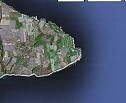
Flamborough Head Anchorages
Courtesy Flag
Flag, Red EnsignWaypoint
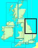
N Anchorage Area 54:08' N 000:06' W S Anchorage Area 54:05'.7 N 000:06'.8 WCharts
Admiralty, 129Rules & Regulations
UnknownHazards
No Particular Hazards other than the possibility of overfalls rounding Flamborough Head and fierce tides.Tidal Data Times & Range
APPROX DATA +0553 Dover MHWS 6.1m, MHWN 4.7m, MLWN 2.3m, MLWS 1.1mThis site is designed for slower, roaming broadband connections, like you would get at sea, so it needs JavaScript enabled to expand the text.
General Description
For the Mariner on passage either up or down this stretch of coast not wishing.....
..... to put into Bridlington with all that might imply... drying out, getting waylaid etc, Flamborough Head offers interesting possibilities.
This large promontory juts out into the sea on such a scale and in such a way that it has two effects. The first is that the tide piles up round it and accelerates, being capable of reaching 3 knts at springs. In wind against tide situations there can be overfalls that are dangerous to small craft, and a minimum offing of 2 miles is recommended in these circumstances. Obviously the skipper will want the tide under him while rounding Flamborough head if at all possible.
The sheer size and shape of Flamborough Head also throws up a couple of good anchoring possibilities, between them offering shelter from most directions other than East. This could prove very useful if you're heading north or south and perhaps needing a break from contrary winds.
The Anchorage to the North of Flamborough Head (North Landing) offers respite from winds from the South West anticlockwise round to the South East.
The Anchorage to the south of Flamborough Head (South Landing) offers protection from winds from the north-east anticlockwise round to the West.
Landing ashore in the dinghy is possible at either of these spots.
Approach
Approaches are best seen on the charts.
It is assumed you will be approaching into the weather, but if coming down wind and intending to get in behind Flamborough Head bear in mind the tidal streams around the head as already mentioned, and the necessity to stand off in strong wind against tide situations.
About six hours before high water Hull the tide starts heading southwards, building up to a maximum at around three hours before high water Hull. Conversely about one hour after high water Hull the tide starts heading northwards reaching its peak around three hours after high water Hull. These times are approximate.
Having decided on your anchorage based on the wind direction (and fairly certain in your own mind that it won't swing easterly during your stay), the approaches are fairly straightforward and clear of dangers. It's simply a matter of finding a suitable spot, with as much shelter as possible, the correct depth, and proximity to the landing spots should you wish to foray ashore.
Berthing, Mooring & Anchoring
The North Anchorage is more steep to than the southern one.
Local fishing boats work off the beach from both of the anchorages, with the RNLI maintaining a station at the South Landing.
Holding is generally good.
Facilities
There are possibilities ashore for the skipper willing to abandon his boat at anchor. There's not too much around the South Landing, but a hike inland (and upwards) brings you to the village of Flamborough... about a mile away. Here you will find various pubs and shops.
The North Anchorage has a pub and cafe more or less on the spot, and is popular with holidaymakers and birdwatchers. The above-mentioned village can also be reached from the North Landing, at about the same distance away.
History
Flamborough Head is an eight mile (˜11.3 km) long promontory on the Yorkshire coast of England, between the Filey and Bridlington bays of the North Sea. It is a chalk headland, and the resistance it offers to coastal erosion may be contrasted with the low coast of Holderness to the south. There are larger numbers and a wider range of cave habitats at Flamborough than at any other chalk site in Britain, the largest of which are known to extend for more than 50 m from their entrance on the coast. Flamborough Head was featured on the television programme Seven Natural Wonders as one of the wonders of Yorkshire.
Flamborough Head has been designated a Special Area of Conservation (SAC) by the British Government's Joint Nature Conservation Committee (JNCC). (Special Areas of Conservation are strictly protected sites designated under the European Community Habitats Directive, which requires the establishment of a European network of important high-quality conservation sites in order to make a significant contribution to conserving the 189 habitat types and 788 species identified in Annexes to this Directive.)
Birds
Seabirds such as gannets and puffins breed abundantly on the cliffs, and nearby Bempton Cliffs has a Royal Society for the Protection of Birds reserve. The shooting of seabirds at Flamborough head was condemned by Professor Alfred Newton in his 1868 speech to the British Association for the Advancement of Science. Local MP Christopher Sykes introduced the Sea Birds Preservation Act 1869, the first Act to protect wild birds in the United Kingdom.
Because it projects into the sea, Flamborough attracts many bird migrants in autumn, and also has a key point for observing passing seabirds. When the winds are in the east, many birders watch for seabirds from below the lighthouse, or later in the autumn comb the hedges and valleys for landbird migrants. Flamborough Head also has a bird observatory. Flamborough Head is the oldest lighthouse place in Britain, dating back to 1674.
Battle of Flamborough Head 1779
A Franco-American squadron fought the Battle of Flamborough Head with a pair of Royal Navy frigates in the American Revolutionary War on 23 September 1779. In the engagement, USS Bonhomme Richard and Pallas, with USS Alliance, captured HMS Serapis and Countess of Scarborough, the best-known incident of Capt. John Paul Jones's naval career. The toposcope at the lighthouse commemorates the 180th anniversary of the battle.
Danes Dyke
Danes Dyke is a 2 mile / 3 km long ditch that runs north and south isolating the seaward 5 square miles / 13 square kilometres of the headland. The dyke and the steep cliffs make the enclosed territory and its two boat launching beaches, North and South Landings, easily defended. Despite its name, the dyke is prehistoric in origin, and Bronze Age arrowheads were found when it was excavated by Major-General Augustus Pitt-Rivers in 1879.
The text on this HISTORY page is covered by the following licence
http://en.wikipedia.org/wiki/Wikipedia:Text_of_the_GNU_Free_Documentation_License
Eating, Drinking & Entertainment
It is unlikely that the skipper will feel comfortable abandoning his boat to anchor and trekking off out of sight of it, especially when he has to leave his dinghy on the beach.
For those lucky enough to have a big crew who know the meaning of taking things in turn, then there is the possibility of a hike to the village and a swift pint or three in the pub.
If anchored off the north landing, then it should be possible to get ashore and enjoy yourself while still being able to keep a weather eye on the boat.
Whichever landing you're at it is extremely unlikely you will be able to land dry shod.
Links
|
Got a comment to make about Flamborough ? Have you found this coverage helpful ? HAVE YOUR SAY (your email address will always be kept private)
Your Ratings & Comments


