Changes Coming- Act Now
Prices on our "For Nav" chart packages have not changed since about 2018/9. As you all know things have gone up dramatically in the last few years, and from 2025 we will also have to increase our chart package prices, roughly in line with inflation.
We are also changing the area coverage available, and separating Spanish and Portugese charts from out of the "ALL" chartpack, which will not exist from 2025. Reason: we are not 100% happy with quantity of raster chart coverage provided by these hydrographic offices vs. the licensing fees we have to pay. They only provide approx 204 raster charts, yet charge double the fees of the UK-IRL set with 826 charts. And also a lot more fees than the new UK-Near Continent set containing 1109+ charts (which will from 2025 include full French coverage right down to the France/Spain border). We will provide the Spanish and Portugese charts as a separate package, bundling in the transatlantic planning charts for those who need this coverage.
"If you need this coverage, our advice to you is to snap up the current "ALL" chart package right now, and you will still get a free 2025 update of your "ALL" chart package in Feb next year. They won't be available to buy as a complete set next year." VMH ForNav Chart packages
"If you want the current "ALL" coverage on the turn-key Android chartplotters we do in conjunction with London Chartplotters.. you better buy it quickly Rugged Tablet Plotter "
From 2025 Chart coverage sets will be:
UK-Ireland:
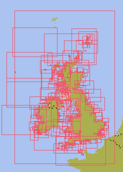
Exactly the sames as now..approx 827 charts, ALL the UKHO raster charts availabe covering UK-IRL.
.
.
2025 prices:
Android Charts for Marine Navigator app (our most popular) £17 (current price £15.95)
Cross Platform Charts for qtVlm £17 (current price £15.95)
Unified Charts by download £27 (current price £33)
.
.
.
.
.
.
NEW UK and Near Continent, now contains FULL French chart coverage down to Spanish border. The SHOM French raster charts are beautiful. Coverage in this package is exhaustive and complete. (But it does not cover Dutch inland waterways.) Over 1100 charts, our best value package charts per £:

2025 prices
Android Charts for Marine Navigator app (our most popular) £38 (current price, for less coverage £29.95)
Cross Platform Charts for qtVlm £38 (current price, for less coverage £29.95)
Unified Charts by download £47 (current price, for less coverage £49)
.
.
.
.
.
.
.
.
.
.
.
.
.
.
.
.
.
NEW Spain, Portugal, and Atlantic planning:
* Wide area coverage *
* inc. detailed coverage of Maderia, Azores, Canary Islands and Cape Verde islands*
* inc. All major Ports and Harbours within Spain and Portugal waters
* All UKHO raster charts available covering mainland Spain and Portugal, plus Balearic Islands, 226 charts*
* Suitable for those setting off from the West Country to Spain and the Med, or to the Azores, Canaries, etc*

2025 prices
Android Charts for Marine Navigator app (our most popular) £42
Cross Platform Charts for qtVlm £42
Unified Charts by download £52
.
.
.
.
.
.
.
.
.
Members discounts will also be changing in 2025, from flat rates to a 20% discount on all chart packages, (including the Cross Platform Charts for qtVLM for the 1st time). Keen eyed readers will see that the Unified Chart packages will be coming down in price, whereas the Marine Navigator charts will be going up a little.
In short any small increases in your favourite "Buy and Keep" chart packages are unlikely to be more than inflation over the last 5 years. Also just to put things in perspective.. our chart packs are often less that the price of one fender, or a few metres of mooring line. They are NOT a subscription (hmmm.. try logging into your subscription charts offshore ) not connected to any play store, not "online", and once you have them set up they will not stop working.... offshore, mid ocean.


