Getting Started 3. Simple routes- Pathways
A huge difference between qtVlm and other Nav programs we've tried is in preparing a route that you can then follow at sea. qtVlm is quite capable of preparing a route for you based on
- 1: A polar diagram for your particular boat and ..
- 2: Grib flles showing Wind, Sea State and Currents for the next few days.
But before we get into these more complex and very interesting features, we will try and show you how to make a simple route yourself.. that does NOT involve anything complicated. First thing to understand is that in VERY simplistic terms:
- 1: A ROUTE is something qtVlm prepares for you based on boat, weather and tide
- 2: A PATHWAY is a simple route that you prepare yourself (same as a route in other nav programs)
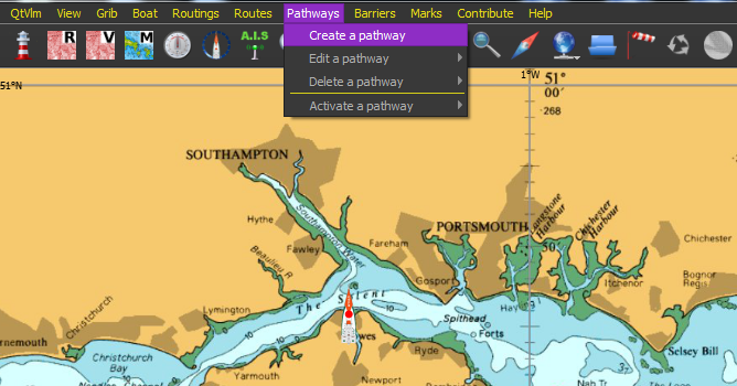
OK let's make a simple pathway (home made route). Click Pathways & Create a Pathway:
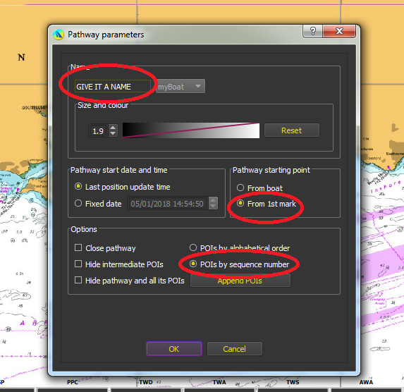
In the box that opens, give it a name, check from 1st mark, and check POIs by sequence number, AND MAKE SURE YOU CLICK "Append POIs" and then OK
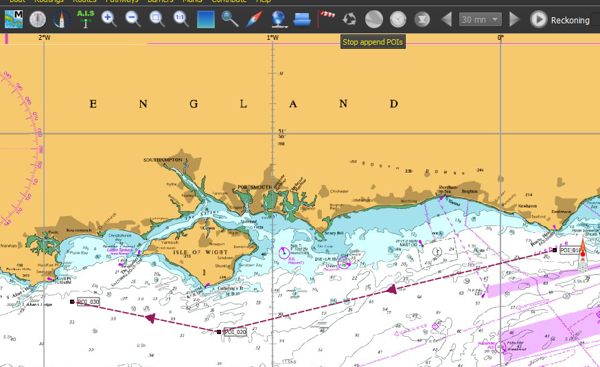
In this case it's a very simple pathway from Beach Head towards Poole with just a few POIs (route points). Click to create a POI, move cursor, click again and so on.. When finished click "Stop append POIs".. there at top of screen:
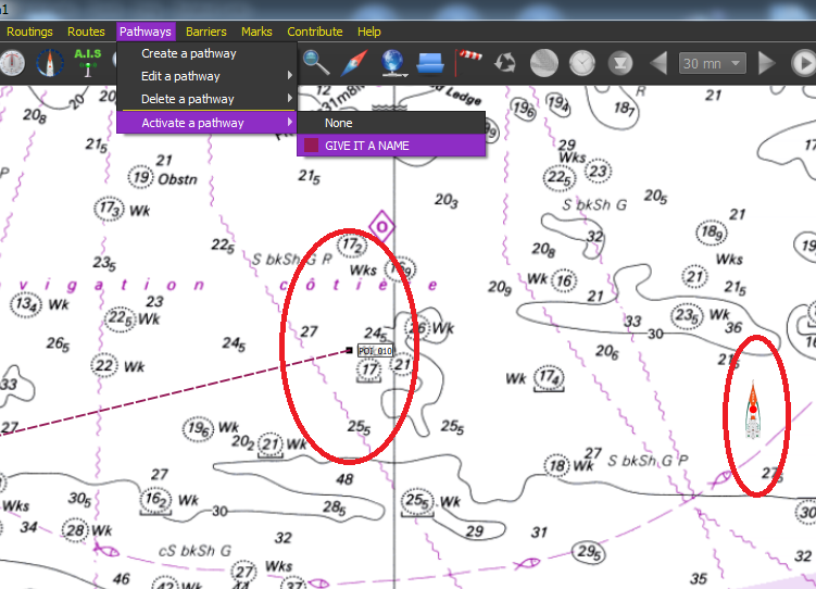
To start following the pathway you've just made (in our case the boat is just to the LH side of the start POI), click Pathways >>> Activate Pathway >> Select the name of the pathway we just made (GIVE IT A NAME)
To get rid of the pathway. Pathways>>> Delete a Pathway
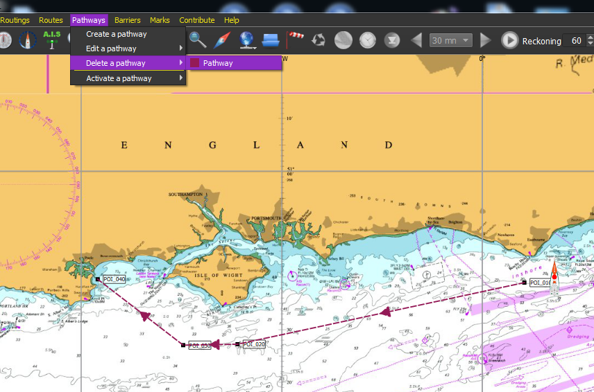
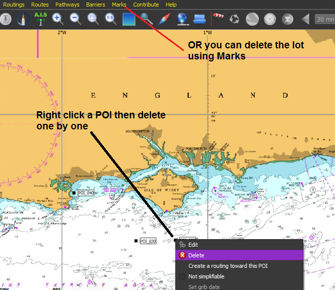
But this will still leave the POIs behind. They can be removed one by one, or deleted en-masse.
Hopefully this little tutorial will get you going with "Pathways".. the equivalent of what we're used to calling routes.
These first 3 tutorials have dealt with the boring basics, we'll soon get onto the interesting stuff that makes qtVlm somewhat different and a lot more fun than the others...
For those with Windows machines (who may also want qtVlm on Android or iPad) UNIFIED CHARTS from mid April 2018 also support qtVlm (as well as the already supported programs and apps.) For those with Macs, Linux, RaspberryPi etc.. We now make CROSS PLATFORM charts that'll work on anything that qtVlm will run on. CLICK HERE

